Go confidently in the direction of your dreams.
Live the life you've imagined. Henry David Thoreau

Slideshows and Photos

SLIDESHOWS LOST TO ICLOUD

SADLY, ON JUNE 30 ALL THE LINKS TO MY SLIDESHOWS WILL DISAPPEAR WHEN APPLE DISCONTINUES "MY GALLERY" AS PART OF THEIR CHANGE TO ICLOUD.

I AM ALSO PREPARING AND PACKING FOR MY PERSONAL MOVE. ONCE I AM SETTLED IN A FEW WEEKS, I WILL START TO POST AGAIN AND LOOK FOR A NEW INTERESTING WAY TO SHARE MY PHOTOS THROUGH MY BLOG.

THANK YOU FOR YOUR INTEREST IN MY TRAVELS. I WILL FIX THINGS AS SOON AS I CAN.

Saturday, February 11, 2012

Paracas, Peru: Tsunami Survivor in the Sechura Desert

August 2011

On August 15, 2007 (4 years prior to our arrival), a significant 8.1 magnitude earthquake hit the southern Peruvian coast just north of the city of Pisco.  Tremors were felt all the way to Lima, but Pisco sustained the worst damage with hundreds killed in the collapsed cathedral and up to 80% of its homes damaged or destroyed.  On the other hand, the nearby, small seaside community of Paracas sustained a 10 meter (32 ft.) tsunami with little building damage or loss of life.   How did Paracas survive so well?  I guess because it was sparsely populated, there were few tall buildings, the tourist boats to the Islas Ballestas had returned for the day, and the tsunami's force  hit the desolate high desert cliffs rising from the sea.    The greatest damage was done to the large rock formations on the coast, especially one known as The Cathedral.

With that history, why would we choose Reserva Nacional de Paracas as a destination?  It is often referred to as Peru's Galapagos, because, despite the arid conditions, there is an amazing variety of sea birds (including Humbolt penguins) and sea mammals which have made this their home.  The waters produce large numbers of krill which also bring a wide variety of fish to this area.  The Paracas Reserve is one of the few marine preserves and is a World Heritage Nature Site.

But the reserve is also part of the Peruvian Sechura Desert which connects with the coastal Chilean Atacama Desert, the driest desert in the world.  I thought it strange that the driest desert should be along a seacoast and just over the mountains from some of the wettest rain forests.  But the Humboldt Current from Antarctica which moves up  the western South American coast is cold and fast and produces fog, but not in-land rain.  The Andes are so tall, they block any moisture trying to escape from the rain forest. Hence,  a very dry desert. As my grandmother lived in a California desert town, I came to appreciate the beauty in desert landscapes and the variety of living things that exist in difficult conditions.  But this is an extreme desert.

It seemed so strange to view the rugged coast with turquoise sea and then to turn around and see only desert sands.  We had an enthusiastic young guide who had grown up with seals and pelicans as friends while his marine-biologist father pursued his research.   As we entered the reserve, we could see at a distance a shallow lake where rare red-winged flamingos were wading.  The roads were made from the natural salt in this mineral rich area.  But this was not always a desert--we saw fossilized sea shells from when it was part of the ocean floor and petrified wood from a time when the climate was more favorable.

But my story wanders.  In order to get to Paracas from our last stop at Lake Titicaca, we had to fly back up to Lima where we met our driver who then took us south along the coast on the famous Pan-American Highway.  The ground became more barren, and we saw numerous small huts where locals established homesteading rights.  There were also many long white tents where chickens (pollo) were raised.  I didn't want to know the conditions under which they were kept.  I seriously doubt that  they were "range-free."  We arrived at our lovely hotel (nicest we had been in so far) in the small town of Paracas late afternoon.  We then headed to the line of restaurants and souvenir stands along the shore to get  a fish dinner.  While locals encouraged us to try the Peruvian specialty ceviche (spicy, marinated raw white fish), I enjoyed instead the crispy corn snacks and delicious cooked sea bass.


After a good night sleep, we were surprised at breakfast to find the Italian friends who had been with us on our Manu Rain Forest adventure at the beginning of our trip (see PE Manu posts).  We swapped stories (their van had lost a wheel on those treacherous jungle mountain roads on the return trip) as we waited for our boat to see the amazing penguins and seals on the Islas Ballestas.  The wildlife was so remarkable that I have given it its own post (next).

So it was not until midday that we wandered into the desert portion of the Paracas Reserve before heading to Nazca.  Paracas is not only the name of a town and a national park, it is also the name of an ancient Pre-Inca people who developed sophisticated pottery and beautiful textiles from 1,000 BC-1 AD, and the name of the blustery winds.  The Paracas wind had started to blow as we came to the coast.  Our guide explained that it often goes in 3-day cycles:  the first day, a persistent high wind; the second, often a blinding sandstorm; and the third day, a gradual decline.  Even though it was the first day, the haze in some of my photos is from the blowing sand, not any city pollution.  They say there are places on this coast which are good for water sports, but you must avoid the deadly rapid currents, the high winds, and the giant, nasty jellyfish.  We were content to just admire this fascinating piece of Planet Earth from the cliffs.

Click link below for slideshow:
Paracas

Music: Tito La Rosa, Tinkuy Pacha, Lo Mejor de Tito la Rosa: Meditacion
Additional Information:  
Insight Guides: Peru
The Essential Book:  Discovering Peru

Tuesday, January 31, 2012

The Breathless Beauty of Isla Taquile, Peru

August 2011

The rocky island of Taquile (not to be confused with the Mexican drink tequila) on Lake Titicaca took my breath away-- literally and figuratively.  Arriving mid-morning after our overnight on Isla Amantani, we docked on the shore at the start of a switchback trail that rose steeply to the top of the island.  Teddie and Dale decided not to attempt the climb up and then the descent down the rocky steps.  They stayed on the boat, as it was to pick us up at the other side of the island in a couple of hours.  We were told there was a cantina with snacks and a waiting area where we would meet. So, once we committed to the climb, there was no way back except to cross the island.  It's a small island (6 km long and 1km wide), but the challenge is in the vertical climb.

Living at sea level, I had chosen to  take my altitude sickness pills (Diamox) and had been staying at high altitudes for over a week, but I quickly found myself huffing and puffing as I started the path to the top of Taquile.  I frequently had to stop for deep breaths and used my raised arm "flapping" exercise to deepen my breaths  and  regain a good breathing pace.  I fell behind the rest of the group and appreciated it when my friends waited and took my slower pace as I moved up the mountain.  However, that did give us the chance to stop to enjoy the magnificent sights of the crystal blue sea and the terraced island.

A characteristic of the island was the arches we saw with three terra cotta heads of men in their broad-brimmed hats.  I never found out its meaning. We were told the rest of the group would meet us at the arch, as they were doing a side trip.  We stayed a few minutes at the first arch, and Jan talked in Spanish with the young girl sitting alone on the hillside, spinning wool and selling family-made knit items to tourists who might come along.  I bought a couple of animal finger puppets that she had made.  The girl spoke Spanish, although the native language of the island is still Quechua.


Realizing this was probably not our meeting place, we started the hike again to the top.  Many of the houses we passed had solar panels to generate some electricity.  We were met on the path (obviously the major thoroughfare) by colorful locals herding horned cows and festive sheep.  Like Amantani, there were no paved roads, cars, or other motorized vehicles.

It was at the third arch leading to the main plaza where we finally did find members of our group.  We had reached a height of 4,033 meters  or 13,231 ft. above sea level.  The square was quite empty around noon on this Sunday.  Somehow, it reminded me of the Bolivian scenes from the movie "Butch Cassidy and the Sundance Kid" even though none of that was filmed by a lake.  Perhaps my mind went there because I could see the misty blue mountains of Bolivia (where they were killed) across Lake Titicaca.  I half-expected some cowboy gun fight to spill out of one of the adobe buildings around the plaza, but it remained quiet, peaceful, and beautiful.

Like Isla Amantani, Taquile  doesn't have hotels, although arrangements can be made to stay with families.  Likewise, arrangements are made with families to provide lunches with typical foods to the groups that come.  We did find a "My House" restaurant near the plaza where we could use the "flush" toilets.  Flushing was accomplished by pouring a bucket of water you carried into the bathroom into the toilet once you were finished.  It worked.

We went with our boat group to our host's house where we sat outside at long tables with a great view.  Our guide then explained the symbolism of hats on the island.  I think the young, unmarried men wear a red  knit cap with a white tassel;  married men have a colored cap with a multi-colored tassel; and the more prominent men add a felt hat on top.  It certainly removes any ambiguity in relationships--although the island is so small, I would think everyone already knows. The rest of the group stayed for lunch, while the three of us started the descent to take some rolls and a little food we had purchased in the plaza to Dale and Teddie.

To get down the mountain on this side of the island, you have to walk down 530+ uneven, rocky steps to the dock below.  There is no railing and rarely a wall or support.  I was ok breathing, so the other two went on ahead with the food.  However, I only walked down about 527+ steps, as I tripped on one, then fell forward down several.   I sat on a step to assess the damage for a few minutes.  My hands and knees were scraped and bruised, and I could tell one knee was bleeding.  Of more concern, I had twisted an ankle.  Fortunately, I had worn short hiking boots or the damage would have been worse, and I did not break my new camera!!!  However, I stared down at the remaining 200+ stairs and wondered if I would have to stay on this island forever.

With stinging hands, a bloodied knee, and a tender ankle, I very slowly and carefully hobbled down the rocky steps.  Whenever I reached a place where I didn't see how I could get down without putting too much weight on my sore ankle (and risk more injury), someone would be coming up or down who kindly offered to help me.  It seemed like I was on those steps forever.  The group that had stayed for lunch were coming down as I finally reached the shore.  Unfortunately,  the cantina at the bottom had been closed, and those of us who hadn't been to lunch had only a few remaining snacks to share.

I got my knee bandaged and kept my swollen ankle elevated as we again crossed the beautiful waters of Lake Titicaca to return to Puno, tired and hungry.   I wrapped my ankle and walked (my hunger was more intense than my pain) a few blocks from our hotel to the main Plaza de Armas.  It was dusk and turning cold, so we just admired the  1757 Cathedral San Carlos Borromeo  from a distance and hurried on to find a welcoming restaurant with brick oven pizza.  We heard a band coming towards the main square, so waited for it.  It appeared to be in support of veterans or in protest of something--we couldn't figure out the purpose of their march.  It went around the near-empty plaza  and left, but then came back down the street and did the same thing two more times during dinner.   I  chose a tasty chicken dinner,  but there was confusion as two of us ordered the same thing and only one dinner was delivered.  But my dinner was worth the extra wait, and I ended it with a cup of delicious, rich, hot chocolate--which, of course, makes any day turn out right.

It was another early morning departure to take us to the airport in the nearby industrial city of Juliaca.  I must admit I had not seen a worse traffic situation since Urumqi, China.  The drivers actually had to be pretty skilled, because there appeared to be no lanes or traffic regulation.  Vehicles simply moved to the nearest empty spot as they worked their way toward their destination.  See if you can figure out which lane we were in!  Amazingly, we made it to the airport and enjoyed our Peru Air flight past the snow-capped volcanoes and deep Colca Canyons with a landing in Arequipa on our way back to Lima.  I wish we had had time to visit Arequipa and search for the Andean condor over the canyons, but we had to return to Lima to start our journey to the Paracas Desert on the southern coast.

Click link below for slideshow:
Isla Taquile

Music:  Allpa, Wanakauri, Machu Pichu
Further Information:  The Essential Book:  Discovering Peru

Saturday, January 21, 2012

Festival Night on Isla Amantani, Lake Titicaca, Peru

August 2011

After our morning visit to the floating Uros Islands on Lake Titicaca, our motorized boat headed to the solid, rocky Isla Amantani.  Amantani is the larger of the 40-some islands of Lake Titicaca and is intertwined with the history of the Inca Empire.   Although the nearby Bolivian islands of the Sun and Moon were considered the sacred birthplace of the Inca race, two of the great Inca Emperors, Pachama and Pachatata, built temples on Amantani.  In the days of Pachatata, it was also used as a prison island because of its isolation. The Spaniards conquered it, and their descendants retained tight control over the inhabitants even after Peru became politically independent.  It wasn't until a bloody rebellion that the indigenous people could create  their current peaceful, communal way of life.  I read there are about 800 families or almost 4,000 people living on the island.

Isla Amntani is about 4 hours by boat from Puno or 2 hours from the Uros Islands over brilliant blue waters, dotted with steep, terraced islands.  When we arrived at Amantani, we were greeted by local women in wool, pleated skirts, bright flowered blouses,  and black shawls with brilliant embroidered flowers who were there to take us to their homes for the night.  One industrious woman even had her hand-drop spindle in hand to make use of the spare moments. (Having previously done some spinning myself, I was impressed by her skill).  


As I had discussed in my Crossing the Andes post, I had decided to take medicine to prevent altitude sickness.  While I did not feel ill as we climbed the hills above the highest navigable lake in the world, my sea-level lungs were really pumping to find some more oxygen at over 12,500 ft.  Several of us took the walk up to the houses rather slowly.  Fortunately, they had placed some stone "mosaics" in the path to make it more interesting to look down.  There are no paved roads or cars or bikes on Amantani.   It is also called the Island of Kantuta, a reddish trumpet flower that is the national flower of Peru and Bolivia, connected (of course)with Inca legends.

Our boat group was divided among several families, but the 5 of us were able to stay together in the home of Isadore and Alfredo, a gracious older couple.  Fortunately, our guide Ruben was a good friend and stayed with them as well, communicating with them in their native Quechua language.  I think "Azezhenki" was "Hello" and "Waliki" meant "I'm fine," but I couldn't figure out where to insert them in a conversation.  The couple graciously accepted our food gifts from the mainland (rice, sugar, etc. that are expensive to have shipped here), and served us a hearty, delicious warm barley vegetable soup with local cheese and bread.  It absolutely hit the spot after a morning at sea.

The rooms in their home were arranged around a courtyard where they kept their tools and a big batch of tuber potatoes that looked more like carrots.  Their quarters and the dining space were downstairs while the guest bedrooms were up steep stairs.  I never understood why the relatively short Incas and Peruvians would create staircases with such tall steps!  The guidebooks all said to expect no electricity or running water, but I think it must have been some time since those authors stayed on the island.  At least in our town (never learned its name), the community uses solar power to give the homes power to use electric lights, but there are no electric appliances or outlets.  Being wintertime, it was nice having electric lights in our rooms when it was dark.

Our house shared a communal courtyard with about 5 houses that had 2 flushing toilets, cold water faucets and a cold shower.  It was there we met Isadore and Alfredo's daughter Gladys and their darling grandchildren, Franklin and Leah.  Franklin (about 9 years old) was eager to use the English he was learning in school (quite good) and to show off his math skills with English answers.  He actually ended  up as our translator and guide for much of that afternoon and evening.

The guidebooks recommended a hike to the Inca ruins at the top of the island for the sunset and then indicated that in the evening, the hosts might have us try on some of their embroidered clothing and teach us their dances.  Again, this was not our experience.  Some of our group found the initial climb challenging, and only Jan went on the hike to the top of the island.  However, as the winter dusk was settling in before they got to the top, she decided to head back down the uneven trail and steps before sunset so that she didn't have to do it in the dark.

While the other tourists were hiking the trail, I had one of the most delightful evenings of the entire trip.  It was the final night of a several-day festival for the local folk.  Isadore and Franklin took me and two others of our group to the little town plaza surrounded by the church and a few town buildings.  The plaza was filled with stalls of lovely handicrafts and locals dressed in their finest.

They were dancing and visiting and just enjoying themselves.  It was such an authentic experience.  Only the vendors paid much attention to the dozen or so tourists that showed up.  The temperature became much colder as the sun started to go down, and I was delighted to replace my old hat and pair of gloves for much warmer and softer alpaca mittens and cap.

But my very, very favorite part was a little girl (3-4  years old) dressed in her green wool pleated shirt and a black embroidered shawl whose constant companion was a young lamb.  Just like in the English nursery rhyme, everywhere this child went, "her lamb was sure to go."  It ran after her across the plaza like a pet dog and never left her side.  OK--I got carried away taking pictures, but it was the sweetest moment.  There was a beautiful sunset, even if we weren't at the top of the island.  As night settled in, we had a filling dinner with another delicious soup, baked vegetables, cheeses, and Munoz herbal tea.  A satisfying end to  a fascinating day.

But our adventures were not yet over.  While I had packed my trusty bright flashlight in my little overnight bag, I had left behind the extra batteries.  So, of course, my batteries gave out.  Teddie and I shared her flashlight for our last trip to the courtyard toilets for the night.  While waiting for a turn,  a cold wind started to blow, and a sudden rain/hail storm moved in as we hurried back to our house and up the outdoor stairs to our frigid room.  We had an electric light, but alas, no heat.  We slept in all our clothes (without shoes) under some very thick blankets.  Teddie had brought some of those metallic emergency blankets which we also spread on top to stay warm.

It was hard to emerge from our warm nest into the cold room in the morning, but the storm had passed, and it was another beautiful sunny day.  After a tasty breakfast with fried "doughnut" bread, we bade farewell to our hosts and started down the hill, watching men already carrying loads of goods from boats up the steep hills to the town.  In less than 24 hours, Isla Amantani had become one of my favorite places in Peru.

When I returned to the States, I was surprised to find in my Whole Foods grocery store, a wild rice/ quinoa blend made by Seeds of Change called Amantani.  The whole grain blend did capture the flavors of the region, and I liked the description on the package:  "upon Lake Titicaca, you'll find the namesake of the product you hold in your hands: a charming little island called Amantani.  It's in this enchanting region that we found the inspiration for red, black, and white quinoa for our Amantani blend."  Life isn't easy on Amantani, but they have made it beautiful.

Clink link below for slideshow:
Amantani

Music:  Peruvian Harp and Flute Ensemble,  Titicaca, The Andes--20 Harp and Flute Favorites
Additional Information: 
http://en.wikipedia.org/wiki/Amantan%C3%AD

Saturday, January 7, 2012

Floating on the Floating Uros Islands of Lake Titicaca, Peru

August 2011

I came to the shores of Lake Titicaca with lots of questions: Why would anyone want to live on an island on the highest navigable lake in the world?  Do the floating islands ever sink or float away?  How do you cook and wash and keep warm on an island of reeds?  Can you grow crops?  What does the "ground" feel like? Does the lake freeze in winter? If this is the highest "navigable" lake, what is the truly highest lake in the world?  etc.   I didn't get all the answers, but will share what I learned.

We spent a chilly winter night (other side of the equator)  in Puno (3,827 meters or over 12,500 ft above sea level), the official capital of Peru's Altiplano Basin and unofficial folklore center, known for its handicrafts, dances, costumes, legends, and fiestas.  Particularly notable is their summer Fiesta of the Virgin of the Candelaria on February 2  which celebrates the reported appearance of the Virgin May to nearby miners.  There can be up to 5,000 musicians and dancers in colorful ethnic costumes.   Under the Spanish, Puno was one of the wealthiest cities on the continent due to its proximity to the very prosperous Laykakota silver mines.  There were volatile disputes during those mining days, and even as we were planning our trip, there were concerns about whether we could stay here due to heated political disputes.  However, those were resolved, and Puno was quiet and nearly deserted on our winter evening.

As we were scheduled to spend the next night on the island Amantani, we packed a small overnight bag and joined a group of about 12 others in the morning for our boating adventure.  As we drove to the docks, we passed a busy street market before entering the inevitable long row of tourist/souvenir shops.  Our motorized boat had comfortable seating, large windows, a viewing deck on top, and a very bright floral carpet on the ceiling of the cabin.

Our boat soon ventured onto the largest lake in South America (8,000+ sq. km or 3,100 sq miles) with an average depth of 107 meters (351 ft).  The lake is a shared border between Peru (60%) and Bolivia (40%), and it is possible to see the Bolivian coast from the taller islands.  While the lake is cold, it does not freeze, and some claim that a fresh-water version of the bull shark can be found in the depths of this lake that is fed by and was probably formed by glaciers (how did sharks get there??).
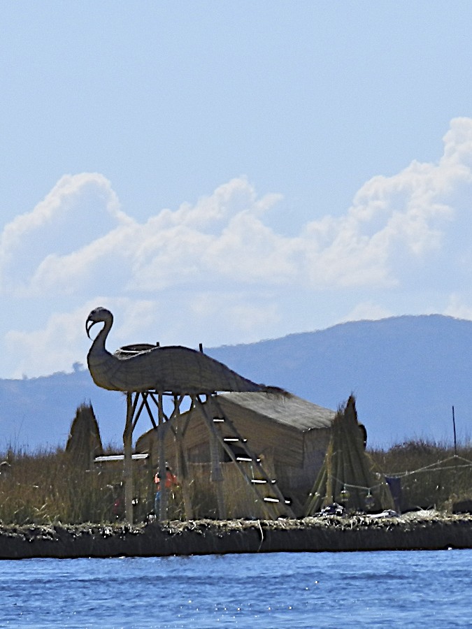
It was a gorgeous day on  Lake Titicaca--bright blue skies; fluffy white clouds; crystal turquoise-blue sea; moderate winds; bright warming sunshine.   I can understand why the Incas considered this a sacred lake and believed that it was here that the sun god's children sprang from its cold waters and went to Cusco to begin the Inca dynasty.  But there were other ethnic groups living on the lake before the Incas. The Uros people also have legends of coming from a divine race.  It is thought they developed the floating reed islands for defensive purposes, far enough off shore that rivals,  Incas, and later Spanish cavaliers would find it difficult to bring their armies against them.  Sadly, it is reported that many of the Uros descendants  died or went to the mainland in the past century before tourism provided an added means of monetary and cultural support.  My poor Spanish was  not so noticeable, as they speak Aymara which I didn't know at all--and a little tourist English.

Before reaching the man-made "artificial" Uros islands, we moved through water channels with natural reed and marshy mini-islands populated by ducks, birds, and even some small pigs and chickens (how did they get there?).  As fish, ducks, and birds are an important part of the islanders' diet, we passed several small boats  of hunters and fishermen that morning.  But the real support (literally) for these islanders is the tortora reed.

We were told there is a population of around 2,00 that live on the 40+ floating islands.  The bases of the islands vary in depths of 2-5 meters of soil (depending of the island's age and care), held together by the roots of the tortora reed and topped with layers of cut reeds.  The layer needs to be constantly renewed, as the reeds dry and break in sunny weather and rot in rain.   There is no dirt for the cultivation of crops.  Each island supports a family grouping, but they have a communal governance and rotate the presidency among the islands.  There are different religious groups as well--Catholics, Protestant, and Mormon (LDS)--but they all seem to get along.  (See article about LDS members http://lds.org/liahona/2011/07/islands-of-faith-a-story-of-diligence?lang=eng&query=lds+lake+titicaca,+peru)

The tortora reed is used to make their houses, watch towers, and boats and is also part of their diet.  The surface of the islands was sort of spongy to walk on  which was particularly difficult for Dale with his crutches.  However, the islands seem securely set where they were (not too far from shore), and there didn't seem to be a likelihood that one might float away to another part of the lake in the middle of the night.

When we arrived on our designated island, we were shown how they cut and use the tortora and invited into their small homes.  Cooking is done outside with a portable pot, and the insides are simply furnished.  The young man who showed me his hut said they keep warm enough in winter with their blankets and sweaters.  However, he had added some modern touches.  With his solar panel, he gets enough electricity to power a battery that runs a small tv!  But I didn't see any ipads yet.

The people were gracious, and the children were delighted to entertain us with songs they had learned in school from different nationalities (with a request for donations).  They also had some lovely handicrafts--especially the stitched and pieced  hangings and tortora reed souvenirs.  I got a small boat mobile.  Then they took us in their reed boat to another floating island where we caught our motorized boat to head toward the rocky island of Amantini (next post).

So what is the really highest lake in the world?  According to google sources, it is a bit further south on the side of the highest active volcano in the world on the border of Chile and Argentina.  However, some consider Ojos del Salado  at 6,390 meters (20,965 ft.) a pool and not a proper lake,  as it is only 100 meters or about 300 ft. in diameter.  If one counts these high unnavigable "pools," Lake Titicaca is only the 35th highest body of water.  But who would want to go around in circles in a pool when one could spend days navigating Lake Titicaca?

Click link below for slideshow:
The Floating Islands of Lake Titicaca
Music:  Alpa, Flor De Un Dia, Machu Picchu
Further Information:
Insight Guides: Peru
The Essential Book: Discovering Peru
http://en.wikipedia.org/wiki/Lake_Titicaca

Friday, December 30, 2011

On the Road to Lake Titicaca, Peru: Huaro, Raqchi, and Pukara

August 2011

Like the ancient Incas, we claimed Cusco as our  "capital" (home base) for our first week in Peru, as we took excursions to the rainforest and Machu Picchu.  But it was finally time for our journey south--ascending to the city of Puno on the shores of Lake Titicaca, the highest navigable lake in the world  (3827 meters; 12,500 ft.).  It was another early morning start as we headed to the depot for our tourist bus departure to Puno at 7 am.  There is a special, luxury pullman-car train that runs a few days a week to nearby Juliaca, but we were very satisfied with our comfortable and uncrowded bus that was perfect for taking photos and naps.  The advantage of the bus was that we were able to make several interesting archaeological stops while finally enjoying a leisurely day.  The best part of all was that the highway was fully paved and smooth, unlike our treacherous route into the Manu Rainforest (see sidebar for Manu post).

Leaving Cusco, we passed a mix of modern buildings, crumbling mud homes, and roadside tented dwellings while enjoying that wonderful Peruvian round bread that was supplied by our kind guide.   We passed the ancient Inca gates of Rumi Qolqa (Rumicolca) which protected the narrow entrance into the Sacred Cusco Valley (see Sacred Valley post).  The protective Inca stone walls were built on foundations of the earlier Wari civilization.

Then, not far south of Cusco, we stopped at the quaint village of Huaro. Our original itinerary had planned a visit to the nearby town of Andahuaylillas to see Peru's "Sistine Chapel"  with its beautiful gilded paintings, but instead we were taken to this more humble site of the Jesuit Temple of St. John the Baptist, originally built in 1571.  The church and its paintings were not well preserved and are now undergoing massive restoration.  However, they are still charming, and the beauty of the interior paintings is easy to imagine.

Originally, local artists painted the walls from 1675-1699 which were later covered in 1802 by more formal paintings by the renowned Tadeo Escalante of both Spanish and Inca descent.  So the dilemma--which layer to restore? There are elements of native folk art and Spanish-Moorish motifs in the decorations.  Photos were not allowed in the interior, so I caught some of the exterior painting and bought postcards. Though it was still early morning,  colorful souvenir stands were already competing for the day's tourists.

We entered a landscape of lakes and fields where rural farmers used animals to pull old wooden plows and adobe bricks were made with straw and set out in the sun to dry.  Yet, here and there, we could see the modern touch of a home satellite disk.  Unlike the hills around Cusco, there were more flat plateaus with mountains rising above them.  In contrast to the yellows, browns, and pine greens, there were also numerous patches of  light blue-green eucalyptus trees that had been imported from Australia.  These trees were brought because they grew quickly and provided good wood for building and firewood.  However, they also rob the soil of the nutrients and water needed for local trees to grow, so they now pose a problem in the areas they were meant to help.

We next stopped at the little village of San Pedro de Cacha with its little church and large plaza, perfect for selling more souvenirs.  I caught the expression of a discouraged vendor and thought about how hard it must be to set up each day in hopes that some stranger would choose your wares.  And, sadly, with luggage limitations, I bought from very few vendors in Peru.  But this little town was once the great Raqchi, an Inca site where the beautiful temple of Wiracocha stood beside palaces and the ever important granaries.  Today it is considered one of the most beautiful and impressive Inca sites.  It is amazing that its tall walls still stand to attest to Inca building skills.  Nearby, there was a family-owned silver shop where we got "good deals" on some lovely pieces and befriended their llamas and alpaca.

Continuing on, we climbed through snow-topped mountains until we reached the division between the regions of Cusco and Puno at another convenient tourist stop in the middle of almost nowhere.  We had actually ascended to the highest point of our journey (4338 meters or 14,232 feet) at the base of Apu (Mount) Chimboya (with a peak at 5700 meters; 18,700 feet).  Souvenirs had shifted from Inca-style pottery to warm alpaca caps and rugs.

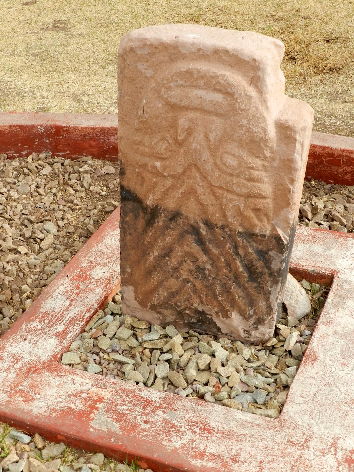
After traveling through the yellow fields of the high Collao Plateau with grazing cattle and llamas, we arrived in Pukara in the late afternoon.  Before coming, I had not heard of this town or the advanced pre-Inca civilization (Pukara) that flourished here from 250 BC-380 AD.  We visited the town's small house-like museum with the typed explanations in Spanish of these remarkable stone sculptures and intricate pottery unlike others found in Southern Peru.  The Pukaras had a well-organized society, although their "population control" method seemed to be periodic warfare to choose the new leader.  They believed in the "decapitating god," as did groups we would later meet in Northern Peru, and so we found statues of bodies standing next to the statues of their upside down heads.  Not how I would want to end up (or down).

Dusk was descending as we drove through the busy industrial city of Juliaca, and a full moon rose as we went on to the lakeside city of Puno, completing our 228 mile journey from Cusco in about 12 hours.  We repacked overnight bags for an early-morning boat departure on Lake Titicaca.  Next post: Floating Uros Islands of Lake Titicaca

Click link below for slideshow:
On the Road to Titicaca

Music:  Tito la Rose, "Lucero de la Manana,"  Lo Mejor de Tito la Rosa: Meditacion
Additional Information:
The Essential Book:Discovering  Peru  
Insight Guide: Peru

Friday, December 9, 2011

Machu Picchu: 100 Years

August 2011

In July 1911, Hiram Bingham, an American explorer/ Yale college professor/ archaeologist/ opportunist, "discovered" Machu Picchu, having been led by indigenous people to Inca ruins in the Andes in his quest to find Old Vilcabamba, the last stronghold of the Incas against the Spaniards.  Bingham acknowledged that his discovery of Machu Picchu was like Columbus' discovery of the New World --there had been prior visitors-- but he,  through associations with the relatively new National Geographic Society, brought this mysterious city of ruins in the tops of the Andes to the attention of the world and put Machu Picchu on the "bucket list" of innumerable travelers.  Adventure heros,  such as Indiana Jones, have been modeled after him.

However, Bingham's legacy was tarnished through the century-long dispute (hopefully, finally resolved last January) between Yale and Peru around his removal of artifacts for the Peabody Museum (mostly burial remains and pottery--Inca gold had already been taken by the Spaniards).  While explorers before him had filled European museums full of Egyptian and Greek treasures, Bingham's discoveries helped awaken Peru's pride in its glorious past and their determination to keep what was theirs. Bingham left Peru after only 4 years.

However,  he was later invited to return to Peru for the dedication of  the twisting Hiram Bingham Highway connecting Aquas Calientes to the ruins and for the 50th anniversary of his discovery, commemorated by a bronze plaque on the site.  His memory has been in and out of favor in Peru, so I'm sure he would be pleased to know that the centennial of his discovery was celebrated this year. ( I just finished a fascinating biography by Christopher Heaney, The Story of Hiram Bingham, a Real-Life Indiana Jones,  and the Search for Machu Picchu.)

While other Peruvians and explorers may have visited or farmed near Machu Picchu in the past, they did not know much about or value the jungle-covered ruins until Hiram Bingham and his group uncovered it.  In fact, when he returned after a couple of years, the jungle had grown back over the ruins he had cleared.  With limited background information, Bingham claimed that Machu Picchu was both the beginning and final city of the Incas, but both these conclusions have now been proven wrong.  (He did also "discover" those ruins, but didn't recognize what they were).  So what is Machu Picchu all about?  As the Incas left no written records, no one really knows its story.

While there is evidence of earlier ruins nearby, it appears that the Incas developed this place about 1438 during the expansion of the Inca empire under the great Inca Pachacutec.  As additional excavations of the site and nearby ruins have proceeded, scholars believe Machu Picchu had a relatively small population and may have served important ceremonial, religious, and agricultural functions.  

Although there appeared to have been a palace, observatories, and temples, it never seemed to be anyone's capital, and there is no evidence its buildings were covered in gold and jewels as in Cusco.  Most notable is the rounded Temple of the Sun which has the most perfect stones in Machu Picchu.   Through its window,  the summer equinox sun appears along the straight edge of the massive center stone.  Lower in the city stands the Temple of the Condor with the Intimachay cave--a solar observatory for the winter solstice.  
Further up are the Temple of the Three Windows and the Principal Temple from which one can climb to the Intihuatana--the "Hitching Post of the Sun"--as Incas called this rising mound from which the Incas made astronomical observations and today's travelers observe the vast beauty of this site.  Its magnificence can also be enjoyed from the lone hut at the top of the stone "fountains"; after a rigorous climb to the Temple  of the Moon on Huayna Picchu  (New Peak); or the more gentle hour hike to Intipunku (Sun Gate).   While the origins and purposes of Machu Picchu are uncertain,  when and why this amazing city was abandoned is even more puzzling.  There is no evidence of conquest, warfare, or natural disaster.  Although its habitation extends into the early period of Spanish domination, it was not part of the flight of Incas from Cuzco.  For reasons unknown, the Inca population appeared to have just left  about a hundred years after creating this remarkable site.  Even the memory of its people and purpose seems to have evaporated into the morning mists.

So, like thousands of others, I came to Peru to ascend Machu Picchu and take the pictures of a lifetime (actually it is a descent of almost 2,000 feet from Cusco--but still over 8,000 feet above sea level).  But, as you may recall from my Cusco post, I got sick after the jungle and my camera stopped working, so I had to spend a day in bed and get a new camera quickly.  Still, I managed to get up the next morning, take a bunch of medications, and jump into the van to the train station with wet hair while carrying my shoes, a new camera that had not even come out of the box, and an overnight bag.   Once we figured out the correct train car, we found PeruRail clean, on time, and comfortable as we enjoyed wide window views of the nearby Veronica Glacier and the Urubamba River.  As we ascended from the river valley, we passed Inca ruins and hardy hikers who had chosen the more rigorous four-day trek on the Inca Trail.  My nephew-in-law and his teenage son enjoyed such a climb last March.

Our train excursion ended at the colorful town, Aquas Calientes, nestled in a mountain gorge where, after following a maze through souvenir stands, we caught the bus up the winding road to the ruins.  Jan and Dale had reservations to stay in the town.   The other three of us had decided on a major splurge to spend the night at the only hotel by the ruins--the five-star Sanctuary Lodge.

As we had made our reservations late, the only room available was still more expensive split three ways than I had ever spent on a room before.  But the hotel was all inclusive--we could order anything at the gourmet restaurant anytime.  Alas, all I wanted for lunch was a bowl of chicken soup (it was good) and ginger ale.  For dinner, it was a simple appetizer, and I didn't even make it to breakfast.  But if I couldn't enjoy the food to my heart's desire,  I certainly enjoyed the luxurious bed and down comforter, the full-spray shower, the soothing, scented candle that was brought for us when the beds were turned down, and the aromatic toiletries.

The next morning I did not make a sunrise walk to the Sun Gate with Jan or attempt the rigorous climb of Huayna Picchu with another of our party, but I did manage to meet our guide for a tour of the ruins.  It was a gorgeous  day in one of the most spectacular spaces on earth.  Just to stand there--breathe the air--gaze at the dramatic verdant mountain peaks and deep valleys--marvel at the stone city hanging on the cliff--I was content.

I was weak from barely eating for two days; I fumbled my way through learning the controls on a new camera;  my battery had not fully charged and quit before I did--leaving me without a photo of myself at Machu Picchu (friends supplied the photos of Aquas Calientes).  Yet, I will always carry an internal picture of myself there.  I did not do all I intended or get the most amazing photos ever--but my spirit was filled with wonder and beauty.  I had made my discovery of Machu Picchu.

We returned by bus to Aquas Calientes for a pizza snack (I was finally hungry) and a little souvenir shopping before our train returned to Cusco in the night.

Click below for slideshow:
Machu Picchu

Music:  Ennio Morricone, The Mission (theme),  The Mission
Further Information:  Christopher Heaney, The Story of Hiram Bingham, a Real-Life Indiana Jones,  and the Search for Machu Picchu, 2011
Insight Guides, Peru