Go confidently in the direction of your dreams.
Live the life you've imagined. Henry David Thoreau

Slideshows and Photos

SLIDESHOWS LOST TO ICLOUD

SADLY, ON JUNE 30 ALL THE LINKS TO MY SLIDESHOWS WILL DISAPPEAR WHEN APPLE DISCONTINUES "MY GALLERY" AS PART OF THEIR CHANGE TO ICLOUD.

I AM ALSO PREPARING AND PACKING FOR MY PERSONAL MOVE. ONCE I AM SETTLED IN A FEW WEEKS, I WILL START TO POST AGAIN AND LOOK FOR A NEW INTERESTING WAY TO SHARE MY PHOTOS THROUGH MY BLOG.

THANK YOU FOR YOUR INTEREST IN MY TRAVELS. I WILL FIX THINGS AS SOON AS I CAN.

Friday, December 30, 2011

On the Road to Lake Titicaca, Peru: Huaro, Raqchi, and Pukara

August 2011

Like the ancient Incas, we claimed Cusco as our  "capital" (home base) for our first week in Peru, as we took excursions to the rainforest and Machu Picchu.  But it was finally time for our journey south--ascending to the city of Puno on the shores of Lake Titicaca, the highest navigable lake in the world  (3827 meters; 12,500 ft.).  It was another early morning start as we headed to the depot for our tourist bus departure to Puno at 7 am.  There is a special, luxury pullman-car train that runs a few days a week to nearby Juliaca, but we were very satisfied with our comfortable and uncrowded bus that was perfect for taking photos and naps.  The advantage of the bus was that we were able to make several interesting archaeological stops while finally enjoying a leisurely day.  The best part of all was that the highway was fully paved and smooth, unlike our treacherous route into the Manu Rainforest (see sidebar for Manu post).

Leaving Cusco, we passed a mix of modern buildings, crumbling mud homes, and roadside tented dwellings while enjoying that wonderful Peruvian round bread that was supplied by our kind guide.   We passed the ancient Inca gates of Rumi Qolqa (Rumicolca) which protected the narrow entrance into the Sacred Cusco Valley (see Sacred Valley post).  The protective Inca stone walls were built on foundations of the earlier Wari civilization.

Then, not far south of Cusco, we stopped at the quaint village of Huaro. Our original itinerary had planned a visit to the nearby town of Andahuaylillas to see Peru's "Sistine Chapel"  with its beautiful gilded paintings, but instead we were taken to this more humble site of the Jesuit Temple of St. John the Baptist, originally built in 1571.  The church and its paintings were not well preserved and are now undergoing massive restoration.  However, they are still charming, and the beauty of the interior paintings is easy to imagine.

Originally, local artists painted the walls from 1675-1699 which were later covered in 1802 by more formal paintings by the renowned Tadeo Escalante of both Spanish and Inca descent.  So the dilemma--which layer to restore? There are elements of native folk art and Spanish-Moorish motifs in the decorations.  Photos were not allowed in the interior, so I caught some of the exterior painting and bought postcards. Though it was still early morning,  colorful souvenir stands were already competing for the day's tourists.

We entered a landscape of lakes and fields where rural farmers used animals to pull old wooden plows and adobe bricks were made with straw and set out in the sun to dry.  Yet, here and there, we could see the modern touch of a home satellite disk.  Unlike the hills around Cusco, there were more flat plateaus with mountains rising above them.  In contrast to the yellows, browns, and pine greens, there were also numerous patches of  light blue-green eucalyptus trees that had been imported from Australia.  These trees were brought because they grew quickly and provided good wood for building and firewood.  However, they also rob the soil of the nutrients and water needed for local trees to grow, so they now pose a problem in the areas they were meant to help.

We next stopped at the little village of San Pedro de Cacha with its little church and large plaza, perfect for selling more souvenirs.  I caught the expression of a discouraged vendor and thought about how hard it must be to set up each day in hopes that some stranger would choose your wares.  And, sadly, with luggage limitations, I bought from very few vendors in Peru.  But this little town was once the great Raqchi, an Inca site where the beautiful temple of Wiracocha stood beside palaces and the ever important granaries.  Today it is considered one of the most beautiful and impressive Inca sites.  It is amazing that its tall walls still stand to attest to Inca building skills.  Nearby, there was a family-owned silver shop where we got "good deals" on some lovely pieces and befriended their llamas and alpaca.

Continuing on, we climbed through snow-topped mountains until we reached the division between the regions of Cusco and Puno at another convenient tourist stop in the middle of almost nowhere.  We had actually ascended to the highest point of our journey (4338 meters or 14,232 feet) at the base of Apu (Mount) Chimboya (with a peak at 5700 meters; 18,700 feet).  Souvenirs had shifted from Inca-style pottery to warm alpaca caps and rugs.

After traveling through the yellow fields of the high Collao Plateau with grazing cattle and llamas, we arrived in Pukara in the late afternoon.  Before coming, I had not heard of this town or the advanced pre-Inca civilization (Pukara) that flourished here from 250 BC-380 AD.  We visited the town's small house-like museum with the typed explanations in Spanish of these remarkable stone sculptures and intricate pottery unlike others found in Southern Peru.  The Pukaras had a well-organized society, although their "population control" method seemed to be periodic warfare to choose the new leader.  They believed in the "decapitating god," as did groups we would later meet in Northern Peru, and so we found statues of bodies standing next to the statues of their upside down heads.  Not how I would want to end up (or down).

Dusk was descending as we drove through the busy industrial city of Juliaca, and a full moon rose as we went on to the lakeside city of Puno, completing our 228 mile journey from Cusco in about 12 hours.  We repacked overnight bags for an early-morning boat departure on Lake Titicaca.  Next post: Floating Uros Islands of Lake Titicaca

Click link below for slideshow:
On the Road to Titicaca

Music:  Tito la Rose, "Lucero de la Manana,"  Lo Mejor de Tito la Rosa: Meditacion
Additional Information:
The Essential Book:Discovering  Peru  
Insight Guide: Peru

Friday, December 9, 2011

Machu Picchu: 100 Years

August 2011

In July 1911, Hiram Bingham, an American explorer/ Yale college professor/ archaeologist/ opportunist, "discovered" Machu Picchu, having been led by indigenous people to Inca ruins in the Andes in his quest to find Old Vilcabamba, the last stronghold of the Incas against the Spaniards.  Bingham acknowledged that his discovery of Machu Picchu was like Columbus' discovery of the New World --there had been prior visitors-- but he,  through associations with the relatively new National Geographic Society, brought this mysterious city of ruins in the tops of the Andes to the attention of the world and put Machu Picchu on the "bucket list" of innumerable travelers.  Adventure heros,  such as Indiana Jones, have been modeled after him.

However, Bingham's legacy was tarnished through the century-long dispute (hopefully, finally resolved last January) between Yale and Peru around his removal of artifacts for the Peabody Museum (mostly burial remains and pottery--Inca gold had already been taken by the Spaniards).  While explorers before him had filled European museums full of Egyptian and Greek treasures, Bingham's discoveries helped awaken Peru's pride in its glorious past and their determination to keep what was theirs. Bingham left Peru after only 4 years.

However,  he was later invited to return to Peru for the dedication of  the twisting Hiram Bingham Highway connecting Aquas Calientes to the ruins and for the 50th anniversary of his discovery, commemorated by a bronze plaque on the site.  His memory has been in and out of favor in Peru, so I'm sure he would be pleased to know that the centennial of his discovery was celebrated this year. ( I just finished a fascinating biography by Christopher Heaney, The Story of Hiram Bingham, a Real-Life Indiana Jones,  and the Search for Machu Picchu.)

While other Peruvians and explorers may have visited or farmed near Machu Picchu in the past, they did not know much about or value the jungle-covered ruins until Hiram Bingham and his group uncovered it.  In fact, when he returned after a couple of years, the jungle had grown back over the ruins he had cleared.  With limited background information, Bingham claimed that Machu Picchu was both the beginning and final city of the Incas, but both these conclusions have now been proven wrong.  (He did also "discover" those ruins, but didn't recognize what they were).  So what is Machu Picchu all about?  As the Incas left no written records, no one really knows its story.

While there is evidence of earlier ruins nearby, it appears that the Incas developed this place about 1438 during the expansion of the Inca empire under the great Inca Pachacutec.  As additional excavations of the site and nearby ruins have proceeded, scholars believe Machu Picchu had a relatively small population and may have served important ceremonial, religious, and agricultural functions.  

Although there appeared to have been a palace, observatories, and temples, it never seemed to be anyone's capital, and there is no evidence its buildings were covered in gold and jewels as in Cusco.  Most notable is the rounded Temple of the Sun which has the most perfect stones in Machu Picchu.   Through its window,  the summer equinox sun appears along the straight edge of the massive center stone.  Lower in the city stands the Temple of the Condor with the Intimachay cave--a solar observatory for the winter solstice.  
Further up are the Temple of the Three Windows and the Principal Temple from which one can climb to the Intihuatana--the "Hitching Post of the Sun"--as Incas called this rising mound from which the Incas made astronomical observations and today's travelers observe the vast beauty of this site.  Its magnificence can also be enjoyed from the lone hut at the top of the stone "fountains"; after a rigorous climb to the Temple  of the Moon on Huayna Picchu  (New Peak); or the more gentle hour hike to Intipunku (Sun Gate).   While the origins and purposes of Machu Picchu are uncertain,  when and why this amazing city was abandoned is even more puzzling.  There is no evidence of conquest, warfare, or natural disaster.  Although its habitation extends into the early period of Spanish domination, it was not part of the flight of Incas from Cuzco.  For reasons unknown, the Inca population appeared to have just left  about a hundred years after creating this remarkable site.  Even the memory of its people and purpose seems to have evaporated into the morning mists.

So, like thousands of others, I came to Peru to ascend Machu Picchu and take the pictures of a lifetime (actually it is a descent of almost 2,000 feet from Cusco--but still over 8,000 feet above sea level).  But, as you may recall from my Cusco post, I got sick after the jungle and my camera stopped working, so I had to spend a day in bed and get a new camera quickly.  Still, I managed to get up the next morning, take a bunch of medications, and jump into the van to the train station with wet hair while carrying my shoes, a new camera that had not even come out of the box, and an overnight bag.   Once we figured out the correct train car, we found PeruRail clean, on time, and comfortable as we enjoyed wide window views of the nearby Veronica Glacier and the Urubamba River.  As we ascended from the river valley, we passed Inca ruins and hardy hikers who had chosen the more rigorous four-day trek on the Inca Trail.  My nephew-in-law and his teenage son enjoyed such a climb last March.

Our train excursion ended at the colorful town, Aquas Calientes, nestled in a mountain gorge where, after following a maze through souvenir stands, we caught the bus up the winding road to the ruins.  Jan and Dale had reservations to stay in the town.   The other three of us had decided on a major splurge to spend the night at the only hotel by the ruins--the five-star Sanctuary Lodge.

As we had made our reservations late, the only room available was still more expensive split three ways than I had ever spent on a room before.  But the hotel was all inclusive--we could order anything at the gourmet restaurant anytime.  Alas, all I wanted for lunch was a bowl of chicken soup (it was good) and ginger ale.  For dinner, it was a simple appetizer, and I didn't even make it to breakfast.  But if I couldn't enjoy the food to my heart's desire,  I certainly enjoyed the luxurious bed and down comforter, the full-spray shower, the soothing, scented candle that was brought for us when the beds were turned down, and the aromatic toiletries.

The next morning I did not make a sunrise walk to the Sun Gate with Jan or attempt the rigorous climb of Huayna Picchu with another of our party, but I did manage to meet our guide for a tour of the ruins.  It was a gorgeous  day in one of the most spectacular spaces on earth.  Just to stand there--breathe the air--gaze at the dramatic verdant mountain peaks and deep valleys--marvel at the stone city hanging on the cliff--I was content.

I was weak from barely eating for two days; I fumbled my way through learning the controls on a new camera;  my battery had not fully charged and quit before I did--leaving me without a photo of myself at Machu Picchu (friends supplied the photos of Aquas Calientes).  Yet, I will always carry an internal picture of myself there.  I did not do all I intended or get the most amazing photos ever--but my spirit was filled with wonder and beauty.  I had made my discovery of Machu Picchu.

We returned by bus to Aquas Calientes for a pizza snack (I was finally hungry) and a little souvenir shopping before our train returned to Cusco in the night.

Click below for slideshow:
Machu Picchu

Music:  Ennio Morricone, The Mission (theme),  The Mission
Further Information:  Christopher Heaney, The Story of Hiram Bingham, a Real-Life Indiana Jones,  and the Search for Machu Picchu, 2011
Insight Guides, Peru

Tuesday, November 29, 2011

Sacred Valley of the Incas: Pisac, Chincero, and Ollantaytambo

August 2011

As noted in my PE Cusco post (see sidebar), I became sick after returning from the jungle and had to spend a day in bed rather than touring.  So, my friend, Teddie, is my guest blogger as she describes  their exploration of the fascinating Sacred Valley of the Incas that day.

"Six o'clock came just too early, but we were soon on our way to the Sacred Valley.  Coco, our guide, shared his knowledge of the area and Inca culture, myths, and religious beliefs. He told us that the reason this valley was so special to the Incas was because of its beauty, climate, variety of plants and animals, and association with the cosmos. The Inca (King) granted it a special "privilege" and it was called "sacred" by the Sons of the Sun. It then became the personal property of the Inca Ruler. 

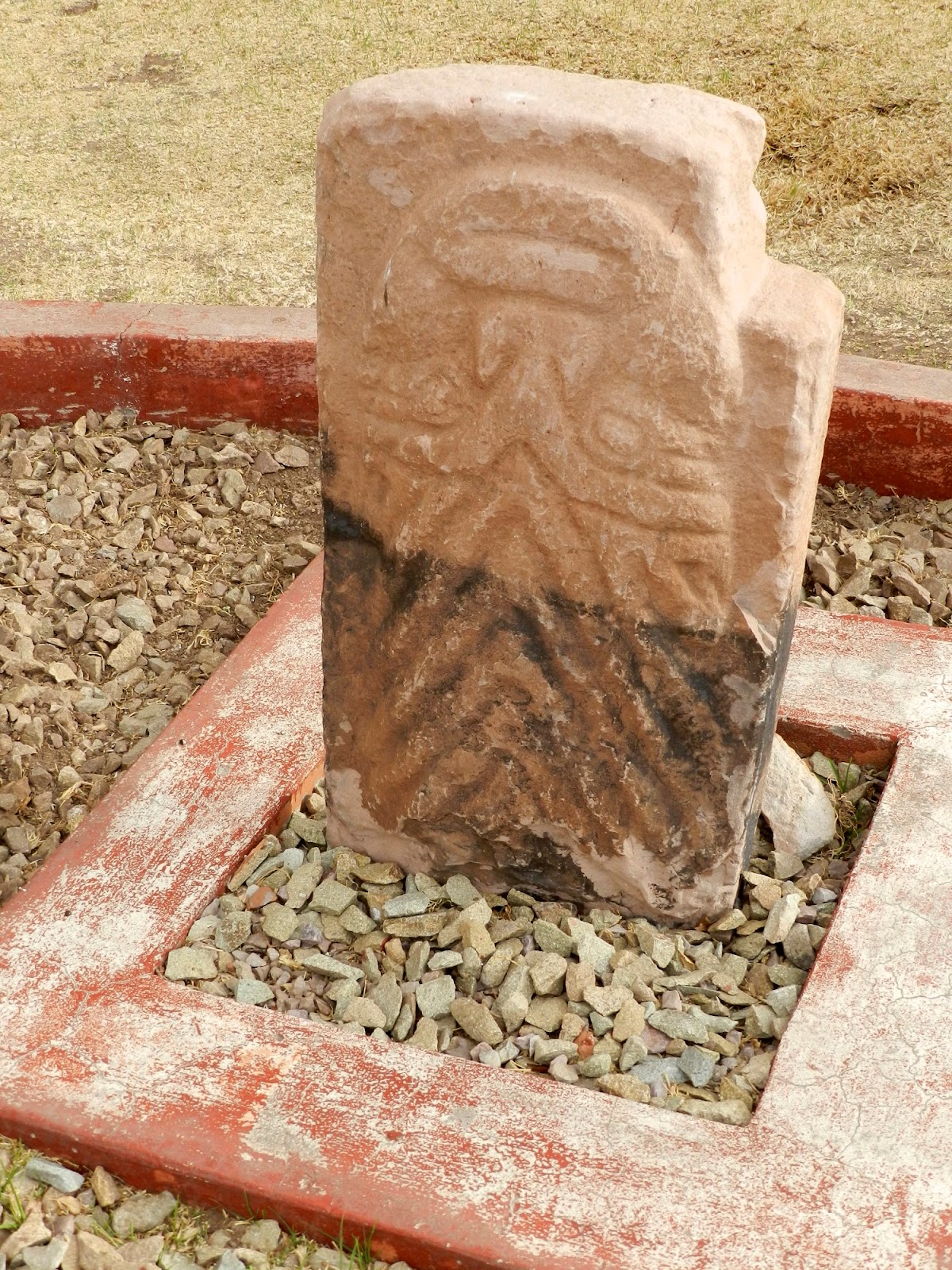
August is winter in Peru, so as we drove over the hills and through the valley everything was brown and barren. At first glance the countryside seemed dry and inhospitable, unable to support the growth of crops, but the promise of harvest was in the terraces that graced every mountain almost to their summits and in the fields that had been turned over, ready for planting. They grow potato, ollluco, oca, quinoa, fava beans, and barley. At the very highest levels on the mountains, they pasture their animals, the alpacas and llamas. The crop they grow there is the bitter potato. We could only imagine the green of the valley as spring and summer approached and in our minds eye, we could imagine what the ancient Incas could see.  Though it was early in the morning,  farmers were already in the fields, and women and young men in native dress were driving their sheep along the side of the road.  We stopped at a market where vendors were eager to sell their native crafts to early tourists.  

Northwest of Cusco is where the Sacred Valley begins. Above the modern town of Pisac, built on the top of a mountain are its archeological ruins. Our van took us up high on the mountain where unbelievable terraces stretched above and below us. Ruins crowned that particular part of the complex, and ancient buildings lined the path where we stood. 


We learned that when you can see the whole of the complex, these ancient terraces, buildings, and the mountain itself, take on the form of a giant condor. The people of the Sacred Valley found a way to sustain themselves and create societies that were in harmony with nature. "They saw the world as a 'living' and interrelated whole of which man is only one part." The gods, myths, and legends were literally woven into the physical characteristics of the mountains that made it possible for the Incas to live. The Incas took advantage of the natural formations already in the physical features of the valley, and then, by carefully building terraces, astronomical observatories, dwellings, channels, canals, etc., they were able to create the forms of their sacred images on the mountainsides. The Sacred Valley was designed to mirror the constellations in the heavens. 

Our next stop was the city plaza in Chinchero, built by the Spanish.  We made our way carefully because the stone pavements were very uneven. The market was huge, vibrant,  and bustling with activity.  Many of the merchants and the families were wearing their colorful native costumes.  Delightful children were playing a form of tag.  However, another little boy and girl were sitting on the curb next to a building on a busy road with vehicles coming within inches of their little toes. I wondered where was their mother.  In the market there were native textiles, leather wallets, nativity scenes, hats, chess sets (Inca vs. Spanish), toys, pan pipes, and everything Peruvian.  

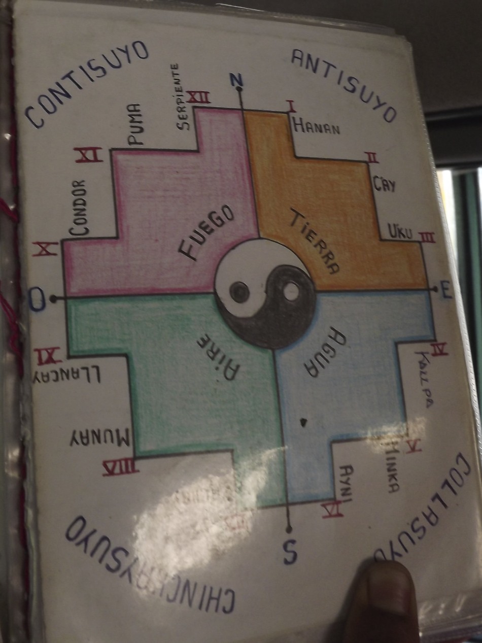
We found a silver merchant with walls full of beautiful jewelry. I found a silver Inca cross pendant that I was looking for.  Coco had explained that the Inca cross has 12 points with a circle in the center. The circle represents Cusco, the "belly button" of the world. The points represent the upper world, the gods and celestial beings (Hanan Pacha); the middle world, life here on the earth (Kay Pacha); and the lower world, the underworld and death (Uqhu Pacha). The points also represent their sacred animals, the Condor, the Puma, and the Snake. Three of the points represent their law:  Don't steal; Don't lie; Don't be lazy. Three more of the points represent their principles:  Love, Knowledge, and Work.  The sweetest scene greeted us as we stepped out of the building. I didn't care that it was orchestrated to charm the tourists into taking pictures which required payment in Peruvian soles. Two beautiful little girls with big brown eyes were all dressed up in their native costumes, each carrying a baby llama in a sling tied around their shoulders.

 Leaving Chincero, we drove through another valley of fields and small towns.  In the towns, I noticed a lot of writing and symbols splashed across the buildings in bright colors.  It looked like graffiti, but, not speaking Spanish, they could have been the business name, address or political message. We saw crops of tuna--not the fish, but a tasty variety of cacti.  We had a buffet lunch of Peruvian specialties with a lot of other tourists in Urubamba.  I declined to try their specialty-- guinea pig. It is an Inca tradition to spill a little liquid on the ground as an offering to Pachamama (Mother Earth goddess). So when I spilled some soup by accident, I chalked it up as my offering to Pachamama.

Ollantaytambo is a simply astonishing site. It was believed to be the seat of the mythical origin of the Inca rulers where they received the knowledge to create harmony between life and the universe.  At the base of the Temple of the Sun, terraces soar up the mountainside, creating the body of a llama, with the Temple being its head and a canal, its eye.  Being worshippers of the sun, light was honored by the Incas and often determined the placement of their buildings and windows.  The constellation of the split tree (the tree of life) is represented in the alluvial fan where the modern town of Ollantaytambo is located. 

Further into the ruins we turned to see a magnificent mountain rise to our right. Coco pointed out a grim visage that occupied the rocky flanks of the mountain. This image, fashioned by nature and man represents Tunupa, a "pilgram teacher of knowledge, a man of great power, and a knower of time." On his back he carries a large bundle and in the rocks of the mountain you can make out the hands that carry it.  At about 2:30 in the afternoon,  he looks to be sleeping, but an hour later he is awake and watching. Again the genius of these Inca engineers is manifested. 

Part of Tunupa's bundle contains the ruins of an ancient Inca granary. Food storage, mostly grains, was an important part of the culture and the evidence of this practice is found throughout the Inca empire. This granary was so high on the mountainside that you can hardly imagine the effort it took to fill it. While we were there we asked Coco what the Incas looked like. With a mischievous grin he told us they stood about so high (he put his hand above his head at about 5'7" or 5'8") they had smooth faces like his (no whiskers), a barrel chest to enable efficient breathing in such high altitudes, strong sturdy legs, and they were handsome, "Just like me."


After a little more exploring, we left to return to Cuzco. We traveled higher and higher, marveling once again at the almost barren winter landscape with few trees.  We saw little adobe houses, some with figures of animals on their roofs and corrals of llamas and alpaca. Finally we reached  the highest point of our travels that day. A few hardy families were set up, selling their wares on the hill overlooking the wide valley below. The cold wind whipped our hair and faces as we stopped to take pictures and do a little shopping. In the distance we could see snow capped mountains.   It seemed that we were far from civilization and all alone at the top of the world.  It was one of our most memorable days in Peru."


Thanks, Teddie, for sharing such a wonderful day.


Click below for slideshow:
The Sacred Valley of the Incas


Music:  Tito La Rosa, Espiritu de la Tierra, Lo Mejor de Tito La Rosa
References:  Fernando E. Salazar and Edgar E. Salazar, Cusco and the Sacred Valley of the Incas
http://www.andeantravelweb.com/peru/destinations/cusco/sacredvalley.html

Sunday, November 20, 2011

The Colossal Walls of Sacsayhuaman, Peru


August 2011

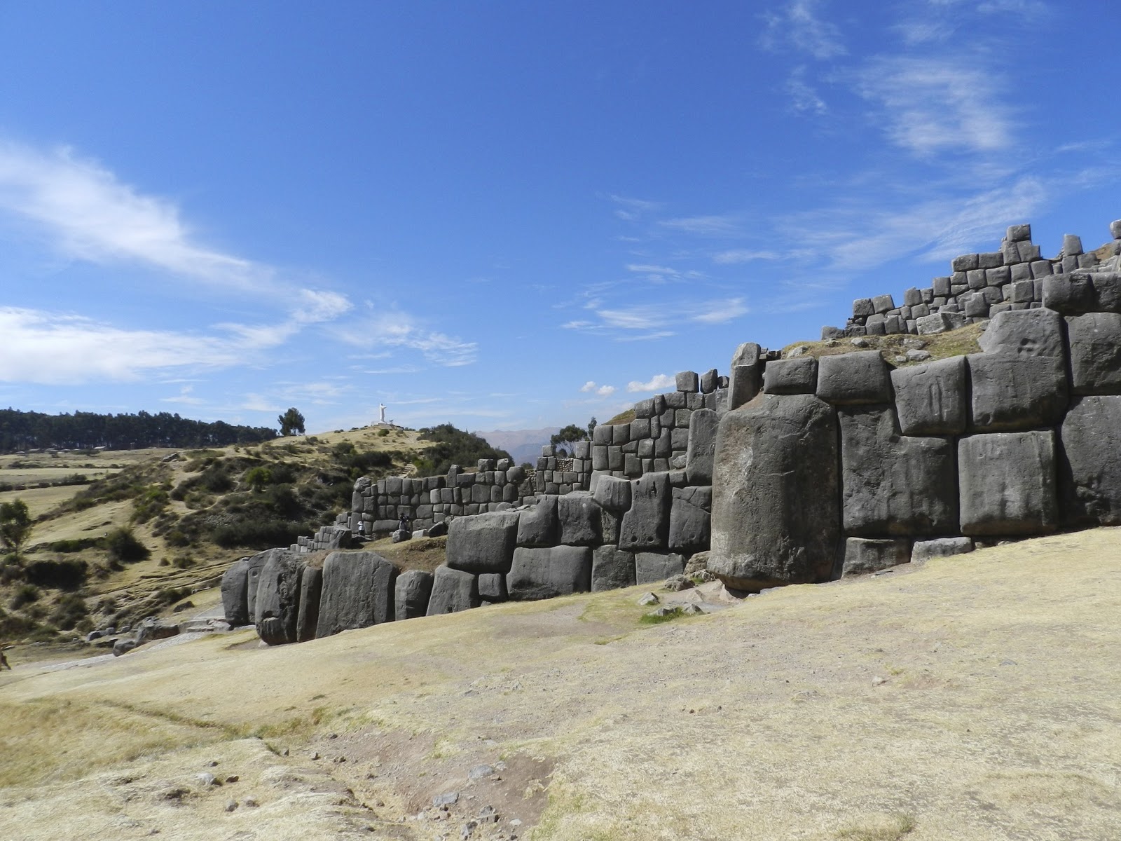
They say that the city of Cusco was designed by the Incas in the shape of the sacred puma or jaguar (see Cusco post on sidebar) with Sacsaywaman as its head, and the jagged, massive stone walls its teeth.  You may again notice the discrepancy in spelling.  It is spelled with both the /h/ and /w/, but is pronounced very much like "saxy woaman," so it has acquired the local nickname of "sexy woman."  While it is fun to joke about going to visit  the "sexy woman," the nickname does not reflect its Inca importance or its bloodied battlefield.

This immense complex (1/3 mile long) was built during the reign of Inca Pachacuttec, at the peak of their empire about 1460 AD.  While it was used as a fortress, it also served political and religious functions.  The complex was built in three terraced levels and was crowned by three towers which were once four stories high.  Many of the stones from the upper walls were later taken by the Spaniards to Cusco to build its cathedral and other buildings.

 The most remarkable thing to see today is the size of the enormous base stones ( some estimated at 125-200 tons) and how they are perfectly fit together without mortar or mud.   It's not as if you could easily re-arrange them if you didn't get it right the first time.  They fit so well together, you can't even slide a piece of paper between some of them.  As with the pyramids of Egypt, we can only wonder at the Inca's accomplishments with their "limited technology."

While one is impressed today just by the stones, chroniclers at the time of the conquest reported that the towers had been covered with sheets of gold and silver as well as beautiful weavings of exotic feathers.  (see Cusco post) The complex seemed magical even to the Spaniards.  Opposite this complex is a lower hill, Suchuna, that was also used in their ceremonies.  There are seats carved into the top of the rock where the Royal Inca and his court would sit to observe the military and religious ceremonies in the field below.

Sacsayhuaman is part of what is called the Sacred Valley and the beginning of the Inca Trail that can lead one up to the distant Machu Picchu.  One hundred years ago, Hiram Bingham, an American explorer (see upcoming Machu Picchu post), searched for the route and place where Manco Inca fled from the Spaniards to set up his new court.

In the process, Bingham not only uncovered Machu Picchu, but later found remarkable ruins of other Inca sites as he followed the overgrown and forgotten Inca Trail (see upcoming post).  Upon seeing Sacsayhuaman, Bingham wrote: "There are few sights in the world more impressive than these Cyclopean walls."

After the Spaniards murdered the Inca ruler, Atahualpa, they allowed his nephew,  Inca Manco, to become their puppet ruler of the Incas in the stronghold of Cusco.  However, as Manco experienced the greed and brutality of the conquistadores, he mobilized a native army for the "great rebellion" and fled into the mountains in 1536.   The Incas quickly reconquered the mighty fortress of Sacsayhuaman, key to the defense of Cusco.

With superior numbers, the Incas retook much of Cusco, but the Spaniards had horses and gunfire.  The rebellion continued for months with atrocities on both sides.  It could have been the end of Spanish rule, but Juan Pissaro (brother to Francisco) risked a calvary attack on Sacsayhuanan.  After a most bloody battle, the  superior weapons, transport, and armor of the Spaniards had won.  Manco and his remaining army fled deeper into the Sacred Valley (next post).

From the height of Sacsayhuaman, one can overlook the city of Cusco (Inca warriors sent flaming arrows into the Spanish town).  As mentioned in the Cusco post,  now the Inti Raymi (Inca festival of the sun) begins  with a procession every June 24 from Cusco to the esplanade facing Sacsayhuaman.

To the east of Sacsayhuaman, is the Inca religious site of Kenko (Qenqo) with two large monoliths  and a series of carved zigzags.  One monolith stands within a semicircular amphitheater and  appears to have been carved in the shape of a monkey before being ruined by the Spaniards.  The larger monolith has a carved passage through it with an altar, probably for the sacrificing of llamas.

Returning to our van,  we passed a boy with his offerings for Pachamama (Mother Earth goddess) as well as a friendly "Inca chief" who plays the flute and makes CDs.  I bought his Relaxation CD.  It provides the background for this and a number of my other posts.  I loved the haunting sounds of the Andean flute which followed us throughout our journey.

Click below for slideshow:
Sacsaywaman

Music:  Tito La Rosa, Llanto del Mundo, Lo Mejor de Tito La Rosa: Meditacion
Additional Information:  http://en.wikipedia.org/wiki/Sacsayhuamán
Insight Guides: Peru
Heaney, Cradle of Gold:  The Story of Hiram Bingham

Wednesday, November 9, 2011

The Memorial for Flight 93 and Shanksville, Pennsylvania


Next post will return to fabled Inca cities I visited in Peru


October 2011

When some friends were in town over  the Columbus Day weekend, they wanted to visit the newly dedicated memorial for the victims who died September 11, 2001 on United Flight 93 near Shankstown, Pennsylvania.  So very early in the morning, we headed northwest on Maryland's highways into hills shrouded in eerie fog and mists.  As the sun started to clear away the fog, it revealed the brilliant colors of trees starting to put on their fall wardrobe of yellows, oranges, and reds.  There  was a pleasant crispness to the air that reminded us that the intense heat of the summer would not return for many months.

Our GPS led us through prosperous farms, tiny towns, and beautiful woods as we wound our  way through Western Pennsylvania.  Then suddenly, in the midst of this peaceful place, we came to the entrance to the memorial dedicated to those brave Americans who, realizing their plane was to be used as a  bomb by terrorists to destroy more lives, chose to fight back and end their lives in this lonely  field.

According to the chronology given at the site, Flight 93 left Newark, New Jersey for San Francisco  after a 25 minute delay due to air traffic.  The Twin Towers were attacked four minutes later;  Flight 77 crashed into the Pentagon a half hour later.  All US aircraft were ordered to land, but the hijackers had already taken control of the plane and turned it toward Washington, DC.  The crew and passengers of Flight 93 had been herded to the back of the plane where they secretively reported the hijacking through cell phones.  Hearing of the other attacks and realizing they would probably be used to attack the nation's capital,  they did the American thing--took a vote and made a plan.   They resisted their guards, attempted to storm the cockpit, and called loved ones on cell phones to share their final thoughts.  According to the black box that was recovered, they never made it into the cockpit, but the hijackers were rolling the plane to thwart the passengers.

The plane was upside down when it flew over the hill and then plunged head first into a field in the Stonycreek Township at 563 miles per hour.   Many citizens of Shanksville (2 miles away) and surrounding areas realized something was terribly wrong when they saw the plane fly over.   First responders were at the site within minutes of the crash, but there were no survivors to save--only fire and smoke.   It soon became apparent that the plane was likely headed for the U.S. Capitol and that it had been part of the planned attack on America that infamous day.

On the morning of September 11, as I watched in disbelief as the Twin Towers and then the Pentagon were attacked, I initially felt secure knowing that my parents were on a family history trip through Western Pennsylvania.  Then I heard of Shanksville.  While my parents were not far from the area, they were safe.  Among the many lessons relearned that day, we  realized how precious, yet uncertain, life is.  (See Moving On post under sidebar September 11)

The memorial for the victims of this flight is still being developed, but Phase I was dedicated for the 10th anniversary on 9/10/2011.   It creates a serene setting to remember the tragedy and sacrifice.  From the entrance sign, one drives about 2 miles further to reach the parking lot for the memorial.  They are preparing to build a larger visitor's center near the knoll that the plane flew over with other special tributes, such as a grove of trees for each victim and a place of wind chimes, symbolizing their voices.  At present, there are a series of photos and explanations that one walks among before passing through a simple covered structure where you can leave comments and stamp your passport, if you thought to bring it.  One then walks along a lengthly passageway which reminded me of a plane's wing, past the bolder in the field decorated with small flags where the plane hit.


A the end of the passageway is a white marble wall, consisting of slabs with the name of each victim.  The wall marks the path taken by the plane before it crashed.  I was moved as I read about the attack and remembered the victims.  But I was also touched by the people who had come to the memorial that day.  There were veterans from other wars, the elderly, the father with his young son, the injured and infirm, and other ordinary folk who all  came to pay their respects to the victims as well as to affirm the strength of our nation.

Leaving the memorial, we  drove through the charming town of Shanksville, hoping to find a restaurant for a late breakfast.  There were no public eating places, but a kind man directed us to his favorite restaurant in nearby Somerset and shared with us his memories of seeing the plane and then the black smoke on 9-11.  After a detour to see a covered bridge built in 1881, we found our way to Somerset, the county seat with its impressive courthouse.

The Kings Family Restaurant may have looked ordinary from the outside, but it was filled with friendly people and scrumptious  food.  Even though we were there for breakfast, I couldn't help noticing their incredible dessert menu, especially their special Double Fudgin' Trouble Sundae where some of the proceeds go to support veterans.  I sure can't think of  better way to support our troops than eating ice cream!

We had a delicious and filling country breakfast (though it was almost noon), and on the way out sampled their delicious berry pie and bought some of their special cinnamon bread and  a box of  Frownies  (brownies with frosted frowns because they "make a mean dessert") which they recommend for "pity parties."  I also made a contribution to the vets even though we didn't get the dessert.  We took another lovely route home, hurrying to get one of  our guests to the DCA airport on time for her flight at the end of a wonderful day, grateful that 10 years later, our skies were safe.

Click below for slideshow:
Flight 93 Memorial

Music:  Pete Seeger, America, the Beautiful, American Favorite Ballads, Vol. 1

More Information:  http://www.nps.gov/flni/index.htm