Go confidently in the direction of your dreams.
Live the life you've imagined. Henry David Thoreau

Slideshows and Photos

SLIDESHOWS LOST TO ICLOUD

SADLY, ON JUNE 30 ALL THE LINKS TO MY SLIDESHOWS WILL DISAPPEAR WHEN APPLE DISCONTINUES "MY GALLERY" AS PART OF THEIR CHANGE TO ICLOUD.

I AM ALSO PREPARING AND PACKING FOR MY PERSONAL MOVE. ONCE I AM SETTLED IN A FEW WEEKS, I WILL START TO POST AGAIN AND LOOK FOR A NEW INTERESTING WAY TO SHARE MY PHOTOS THROUGH MY BLOG.

THANK YOU FOR YOUR INTEREST IN MY TRAVELS. I WILL FIX THINGS AS SOON AS I CAN.

Tuesday, November 29, 2011

Sacred Valley of the Incas: Pisac, Chincero, and Ollantaytambo

August 2011

As noted in my PE Cusco post (see sidebar), I became sick after returning from the jungle and had to spend a day in bed rather than touring.  So, my friend, Teddie, is my guest blogger as she describes  their exploration of the fascinating Sacred Valley of the Incas that day.

"Six o'clock came just too early, but we were soon on our way to the Sacred Valley.  Coco, our guide, shared his knowledge of the area and Inca culture, myths, and religious beliefs. He told us that the reason this valley was so special to the Incas was because of its beauty, climate, variety of plants and animals, and association with the cosmos. The Inca (King) granted it a special "privilege" and it was called "sacred" by the Sons of the Sun. It then became the personal property of the Inca Ruler. 

August is winter in Peru, so as we drove over the hills and through the valley everything was brown and barren. At first glance the countryside seemed dry and inhospitable, unable to support the growth of crops, but the promise of harvest was in the terraces that graced every mountain almost to their summits and in the fields that had been turned over, ready for planting. They grow potato, ollluco, oca, quinoa, fava beans, and barley. At the very highest levels on the mountains, they pasture their animals, the alpacas and llamas. The crop they grow there is the bitter potato. We could only imagine the green of the valley as spring and summer approached and in our minds eye, we could imagine what the ancient Incas could see.  Though it was early in the morning,  farmers were already in the fields, and women and young men in native dress were driving their sheep along the side of the road.  We stopped at a market where vendors were eager to sell their native crafts to early tourists.  

Northwest of Cusco is where the Sacred Valley begins. Above the modern town of Pisac, built on the top of a mountain are its archeological ruins. Our van took us up high on the mountain where unbelievable terraces stretched above and below us. Ruins crowned that particular part of the complex, and ancient buildings lined the path where we stood. 


We learned that when you can see the whole of the complex, these ancient terraces, buildings, and the mountain itself, take on the form of a giant condor. The people of the Sacred Valley found a way to sustain themselves and create societies that were in harmony with nature. "They saw the world as a 'living' and interrelated whole of which man is only one part." The gods, myths, and legends were literally woven into the physical characteristics of the mountains that made it possible for the Incas to live. The Incas took advantage of the natural formations already in the physical features of the valley, and then, by carefully building terraces, astronomical observatories, dwellings, channels, canals, etc., they were able to create the forms of their sacred images on the mountainsides. The Sacred Valley was designed to mirror the constellations in the heavens. 

Our next stop was the city plaza in Chinchero, built by the Spanish.  We made our way carefully because the stone pavements were very uneven. The market was huge, vibrant,  and bustling with activity.  Many of the merchants and the families were wearing their colorful native costumes.  Delightful children were playing a form of tag.  However, another little boy and girl were sitting on the curb next to a building on a busy road with vehicles coming within inches of their little toes. I wondered where was their mother.  In the market there were native textiles, leather wallets, nativity scenes, hats, chess sets (Inca vs. Spanish), toys, pan pipes, and everything Peruvian.  

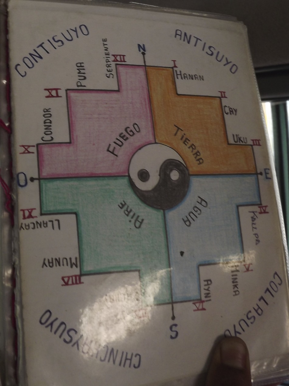
We found a silver merchant with walls full of beautiful jewelry. I found a silver Inca cross pendant that I was looking for.  Coco had explained that the Inca cross has 12 points with a circle in the center. The circle represents Cusco, the "belly button" of the world. The points represent the upper world, the gods and celestial beings (Hanan Pacha); the middle world, life here on the earth (Kay Pacha); and the lower world, the underworld and death (Uqhu Pacha). The points also represent their sacred animals, the Condor, the Puma, and the Snake. Three of the points represent their law:  Don't steal; Don't lie; Don't be lazy. Three more of the points represent their principles:  Love, Knowledge, and Work.  The sweetest scene greeted us as we stepped out of the building. I didn't care that it was orchestrated to charm the tourists into taking pictures which required payment in Peruvian soles. Two beautiful little girls with big brown eyes were all dressed up in their native costumes, each carrying a baby llama in a sling tied around their shoulders.

 Leaving Chincero, we drove through another valley of fields and small towns.  In the towns, I noticed a lot of writing and symbols splashed across the buildings in bright colors.  It looked like graffiti, but, not speaking Spanish, they could have been the business name, address or political message. We saw crops of tuna--not the fish, but a tasty variety of cacti.  We had a buffet lunch of Peruvian specialties with a lot of other tourists in Urubamba.  I declined to try their specialty-- guinea pig. It is an Inca tradition to spill a little liquid on the ground as an offering to Pachamama (Mother Earth goddess). So when I spilled some soup by accident, I chalked it up as my offering to Pachamama.

Ollantaytambo is a simply astonishing site. It was believed to be the seat of the mythical origin of the Inca rulers where they received the knowledge to create harmony between life and the universe.  At the base of the Temple of the Sun, terraces soar up the mountainside, creating the body of a llama, with the Temple being its head and a canal, its eye.  Being worshippers of the sun, light was honored by the Incas and often determined the placement of their buildings and windows.  The constellation of the split tree (the tree of life) is represented in the alluvial fan where the modern town of Ollantaytambo is located. 

Further into the ruins we turned to see a magnificent mountain rise to our right. Coco pointed out a grim visage that occupied the rocky flanks of the mountain. This image, fashioned by nature and man represents Tunupa, a "pilgram teacher of knowledge, a man of great power, and a knower of time." On his back he carries a large bundle and in the rocks of the mountain you can make out the hands that carry it.  At about 2:30 in the afternoon,  he looks to be sleeping, but an hour later he is awake and watching. Again the genius of these Inca engineers is manifested. 

Part of Tunupa's bundle contains the ruins of an ancient Inca granary. Food storage, mostly grains, was an important part of the culture and the evidence of this practice is found throughout the Inca empire. This granary was so high on the mountainside that you can hardly imagine the effort it took to fill it. While we were there we asked Coco what the Incas looked like. With a mischievous grin he told us they stood about so high (he put his hand above his head at about 5'7" or 5'8") they had smooth faces like his (no whiskers), a barrel chest to enable efficient breathing in such high altitudes, strong sturdy legs, and they were handsome, "Just like me."


After a little more exploring, we left to return to Cuzco. We traveled higher and higher, marveling once again at the almost barren winter landscape with few trees.  We saw little adobe houses, some with figures of animals on their roofs and corrals of llamas and alpaca. Finally we reached  the highest point of our travels that day. A few hardy families were set up, selling their wares on the hill overlooking the wide valley below. The cold wind whipped our hair and faces as we stopped to take pictures and do a little shopping. In the distance we could see snow capped mountains.   It seemed that we were far from civilization and all alone at the top of the world.  It was one of our most memorable days in Peru."


Thanks, Teddie, for sharing such a wonderful day.


Click below for slideshow:
The Sacred Valley of the Incas


Music:  Tito La Rosa, Espiritu de la Tierra, Lo Mejor de Tito La Rosa
References:  Fernando E. Salazar and Edgar E. Salazar, Cusco and the Sacred Valley of the Incas
http://www.andeantravelweb.com/peru/destinations/cusco/sacredvalley.html

Sunday, November 20, 2011

The Colossal Walls of Sacsayhuaman, Peru


August 2011

They say that the city of Cusco was designed by the Incas in the shape of the sacred puma or jaguar (see Cusco post on sidebar) with Sacsaywaman as its head, and the jagged, massive stone walls its teeth.  You may again notice the discrepancy in spelling.  It is spelled with both the /h/ and /w/, but is pronounced very much like "saxy woaman," so it has acquired the local nickname of "sexy woman."  While it is fun to joke about going to visit  the "sexy woman," the nickname does not reflect its Inca importance or its bloodied battlefield.

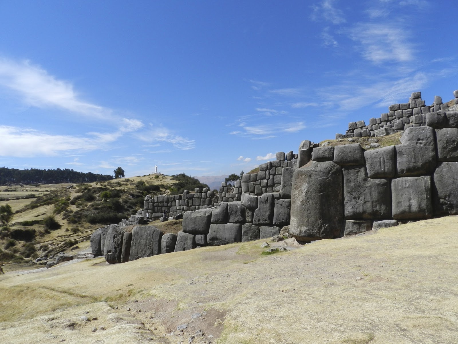
This immense complex (1/3 mile long) was built during the reign of Inca Pachacuttec, at the peak of their empire about 1460 AD.  While it was used as a fortress, it also served political and religious functions.  The complex was built in three terraced levels and was crowned by three towers which were once four stories high.  Many of the stones from the upper walls were later taken by the Spaniards to Cusco to build its cathedral and other buildings.

 The most remarkable thing to see today is the size of the enormous base stones ( some estimated at 125-200 tons) and how they are perfectly fit together without mortar or mud.   It's not as if you could easily re-arrange them if you didn't get it right the first time.  They fit so well together, you can't even slide a piece of paper between some of them.  As with the pyramids of Egypt, we can only wonder at the Inca's accomplishments with their "limited technology."

While one is impressed today just by the stones, chroniclers at the time of the conquest reported that the towers had been covered with sheets of gold and silver as well as beautiful weavings of exotic feathers.  (see Cusco post) The complex seemed magical even to the Spaniards.  Opposite this complex is a lower hill, Suchuna, that was also used in their ceremonies.  There are seats carved into the top of the rock where the Royal Inca and his court would sit to observe the military and religious ceremonies in the field below.

Sacsayhuaman is part of what is called the Sacred Valley and the beginning of the Inca Trail that can lead one up to the distant Machu Picchu.  One hundred years ago, Hiram Bingham, an American explorer (see upcoming Machu Picchu post), searched for the route and place where Manco Inca fled from the Spaniards to set up his new court.

In the process, Bingham not only uncovered Machu Picchu, but later found remarkable ruins of other Inca sites as he followed the overgrown and forgotten Inca Trail (see upcoming post).  Upon seeing Sacsayhuaman, Bingham wrote: "There are few sights in the world more impressive than these Cyclopean walls."

After the Spaniards murdered the Inca ruler, Atahualpa, they allowed his nephew,  Inca Manco, to become their puppet ruler of the Incas in the stronghold of Cusco.  However, as Manco experienced the greed and brutality of the conquistadores, he mobilized a native army for the "great rebellion" and fled into the mountains in 1536.   The Incas quickly reconquered the mighty fortress of Sacsayhuaman, key to the defense of Cusco.

With superior numbers, the Incas retook much of Cusco, but the Spaniards had horses and gunfire.  The rebellion continued for months with atrocities on both sides.  It could have been the end of Spanish rule, but Juan Pissaro (brother to Francisco) risked a calvary attack on Sacsayhuanan.  After a most bloody battle, the  superior weapons, transport, and armor of the Spaniards had won.  Manco and his remaining army fled deeper into the Sacred Valley (next post).

From the height of Sacsayhuaman, one can overlook the city of Cusco (Inca warriors sent flaming arrows into the Spanish town).  As mentioned in the Cusco post,  now the Inti Raymi (Inca festival of the sun) begins  with a procession every June 24 from Cusco to the esplanade facing Sacsayhuaman.

To the east of Sacsayhuaman, is the Inca religious site of Kenko (Qenqo) with two large monoliths  and a series of carved zigzags.  One monolith stands within a semicircular amphitheater and  appears to have been carved in the shape of a monkey before being ruined by the Spaniards.  The larger monolith has a carved passage through it with an altar, probably for the sacrificing of llamas.

Returning to our van,  we passed a boy with his offerings for Pachamama (Mother Earth goddess) as well as a friendly "Inca chief" who plays the flute and makes CDs.  I bought his Relaxation CD.  It provides the background for this and a number of my other posts.  I loved the haunting sounds of the Andean flute which followed us throughout our journey.

Click below for slideshow:
Sacsaywaman

Music:  Tito La Rosa, Llanto del Mundo, Lo Mejor de Tito La Rosa: Meditacion
Additional Information:  http://en.wikipedia.org/wiki/Sacsayhuamán
Insight Guides: Peru
Heaney, Cradle of Gold:  The Story of Hiram Bingham

Wednesday, November 9, 2011

The Memorial for Flight 93 and Shanksville, Pennsylvania


Next post will return to fabled Inca cities I visited in Peru


October 2011

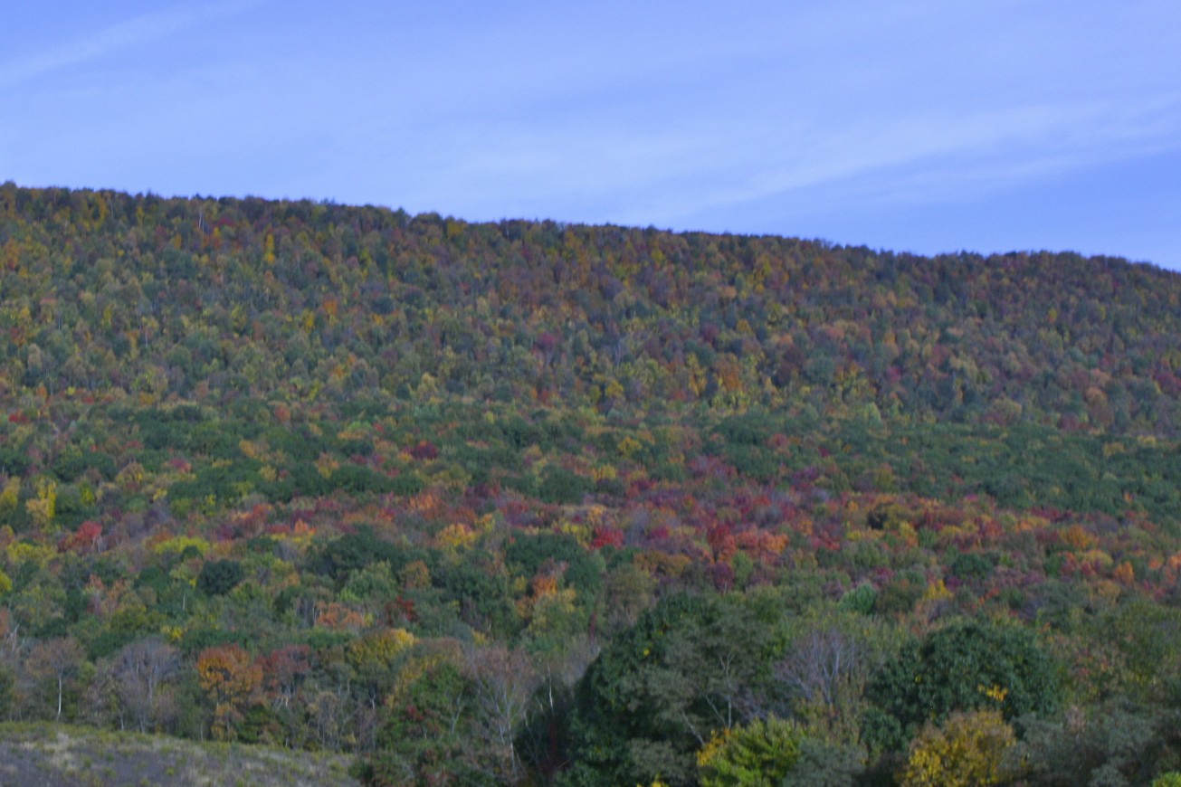
When some friends were in town over  the Columbus Day weekend, they wanted to visit the newly dedicated memorial for the victims who died September 11, 2001 on United Flight 93 near Shankstown, Pennsylvania.  So very early in the morning, we headed northwest on Maryland's highways into hills shrouded in eerie fog and mists.  As the sun started to clear away the fog, it revealed the brilliant colors of trees starting to put on their fall wardrobe of yellows, oranges, and reds.  There  was a pleasant crispness to the air that reminded us that the intense heat of the summer would not return for many months.

Our GPS led us through prosperous farms, tiny towns, and beautiful woods as we wound our  way through Western Pennsylvania.  Then suddenly, in the midst of this peaceful place, we came to the entrance to the memorial dedicated to those brave Americans who, realizing their plane was to be used as a  bomb by terrorists to destroy more lives, chose to fight back and end their lives in this lonely  field.

According to the chronology given at the site, Flight 93 left Newark, New Jersey for San Francisco  after a 25 minute delay due to air traffic.  The Twin Towers were attacked four minutes later;  Flight 77 crashed into the Pentagon a half hour later.  All US aircraft were ordered to land, but the hijackers had already taken control of the plane and turned it toward Washington, DC.  The crew and passengers of Flight 93 had been herded to the back of the plane where they secretively reported the hijacking through cell phones.  Hearing of the other attacks and realizing they would probably be used to attack the nation's capital,  they did the American thing--took a vote and made a plan.   They resisted their guards, attempted to storm the cockpit, and called loved ones on cell phones to share their final thoughts.  According to the black box that was recovered, they never made it into the cockpit, but the hijackers were rolling the plane to thwart the passengers.

The plane was upside down when it flew over the hill and then plunged head first into a field in the Stonycreek Township at 563 miles per hour.   Many citizens of Shanksville (2 miles away) and surrounding areas realized something was terribly wrong when they saw the plane fly over.   First responders were at the site within minutes of the crash, but there were no survivors to save--only fire and smoke.   It soon became apparent that the plane was likely headed for the U.S. Capitol and that it had been part of the planned attack on America that infamous day.

On the morning of September 11, as I watched in disbelief as the Twin Towers and then the Pentagon were attacked, I initially felt secure knowing that my parents were on a family history trip through Western Pennsylvania.  Then I heard of Shanksville.  While my parents were not far from the area, they were safe.  Among the many lessons relearned that day, we  realized how precious, yet uncertain, life is.  (See Moving On post under sidebar September 11)

The memorial for the victims of this flight is still being developed, but Phase I was dedicated for the 10th anniversary on 9/10/2011.   It creates a serene setting to remember the tragedy and sacrifice.  From the entrance sign, one drives about 2 miles further to reach the parking lot for the memorial.  They are preparing to build a larger visitor's center near the knoll that the plane flew over with other special tributes, such as a grove of trees for each victim and a place of wind chimes, symbolizing their voices.  At present, there are a series of photos and explanations that one walks among before passing through a simple covered structure where you can leave comments and stamp your passport, if you thought to bring it.  One then walks along a lengthly passageway which reminded me of a plane's wing, past the bolder in the field decorated with small flags where the plane hit.


A the end of the passageway is a white marble wall, consisting of slabs with the name of each victim.  The wall marks the path taken by the plane before it crashed.  I was moved as I read about the attack and remembered the victims.  But I was also touched by the people who had come to the memorial that day.  There were veterans from other wars, the elderly, the father with his young son, the injured and infirm, and other ordinary folk who all  came to pay their respects to the victims as well as to affirm the strength of our nation.

Leaving the memorial, we  drove through the charming town of Shanksville, hoping to find a restaurant for a late breakfast.  There were no public eating places, but a kind man directed us to his favorite restaurant in nearby Somerset and shared with us his memories of seeing the plane and then the black smoke on 9-11.  After a detour to see a covered bridge built in 1881, we found our way to Somerset, the county seat with its impressive courthouse.

The Kings Family Restaurant may have looked ordinary from the outside, but it was filled with friendly people and scrumptious  food.  Even though we were there for breakfast, I couldn't help noticing their incredible dessert menu, especially their special Double Fudgin' Trouble Sundae where some of the proceeds go to support veterans.  I sure can't think of  better way to support our troops than eating ice cream!

We had a delicious and filling country breakfast (though it was almost noon), and on the way out sampled their delicious berry pie and bought some of their special cinnamon bread and  a box of  Frownies  (brownies with frosted frowns because they "make a mean dessert") which they recommend for "pity parties."  I also made a contribution to the vets even though we didn't get the dessert.  We took another lovely route home, hurrying to get one of  our guests to the DCA airport on time for her flight at the end of a wonderful day, grateful that 10 years later, our skies were safe.

Click below for slideshow:
Flight 93 Memorial

Music:  Pete Seeger, America, the Beautiful, American Favorite Ballads, Vol. 1

More Information:  http://www.nps.gov/flni/index.htm

Sunday, October 30, 2011

Cusco, Peru: City of the Sacred Jaguar

August 2011

To the Incas--the children of the sun---there were three sacred animals:  the condor (representing the heavens), the puma or jaguar (representing the earth), and the snake (representing the underworld).  They say Cusco*, the ancient capital of the great Inca empire, was designed in the shape of the puma.  It must have been an amazing city.  Situated high in the majestic Andes (over 10,000 ft or  3,000 meters), the walls of the glittering temple to the sun god Inti were covered in 700 sheets of gold, studded with emeralds and turquoise.

Cusco's ancient streets were paved; there were sophisticated water systems; and the buildings were constructed of perfectly fit stones without mortar.  From Qosqo, as they called it in the ancient Quechua language, the Incas ruled an empire that stretched north to Colombia and south to Chile and Argentina--  until the Spanish conquistadores arrived in 1533, hungry for gold and eager to impose their rule and religion.

As our van climbed nearly 10,000 ft. to return to Cusco from our rainforest adventures in Manu (see PE Manu posts on sidebar), a chilly wind began to blow. We hurried  back on those narrow dirt/gravel roads to reach  the highway outside Cusco before dark.  By then, not only had my prized DSLR camera stopped working, but I had an error message on my secondary camera that kept shutting it down.  Arriving in Cusco, we were surprised to be dropped off in the cold and dark at the main square far from our hotel, but our faithful guide, Nefi, took us back in a cab.

However, my chill did not subside when we returned to the hotel.  Despite several warm blankets, I spent a restless night, shivering and trying to quench my thirst with bottled water.  By dawn, I realized this was  not altitude sickness.  On my fifth day in Peru, I was sick--feverish from an intestinal bug (not the food)--and without a working camera.  Discouraged, I told the others to go on the excursions, and I spent the day in bed  (or in the bathroom).

By evening, I was somewhat better (ate toast and crackers) and was still determined to go to Machu Picchu the next day with a working camera.  With the assistance of a bilingual hotel employee and one of my friends, we took a cab at 9 p.m. to a camera shop where I bought a decent camera for twice what it costs on a good deal in the US.  But what else would you expect for a desperate, sick, non-Spanish speaking customer just before closing?

All this to say that in the next several posts, I will rely on the comments and photos of my traveling companions for those sights I did not see or photograph.  Fortunately, I had come prepared with Immodium and the prescription medicine Cipro, just in case of such an emergency illness.  It still took a few days before I fully recovered, but at least I was able to continue my journey.

While Cusco no longer glitters with gold, the Incan stones still form the foundations of many buildings and churches and provide contrast for the brilliantly colored wraps and clothes of its mostly indigenous population.  Despite uneven stone pavements, the tall curbs, and steep inclines, I found the streets of Cusco fascinating as the residents conducted their daily business.  When we needed to exchange money, our travel agent, Elvis, led us to a corner where a seemingly reputable person gave us Peruvian sols for US dollars out of his pocket at a good rate with no receipts or identification required.  But exchange shops didn't ask for ID or give receipts either.  It was just how they did business.

In Cusco, we were joined by our friends, Jan and Dale.  Jan had arrived in Peru a week earlier in order to attend Spanish language classes in Cusco.  Although she had spoken Spanish in her mission in South America for the LDS (Mormon) Church many years before, she wanted to refresh her skills.  She enjoyed her extended stay in Cusco and was an invaluable translator for us as we made our way around Peru.  One afternoon, we explored a colorful local market together.

We found Peruvian food delicious and easy to adapt to.  While sick, I stayed with soups, breads, and chicken dishes, but later enjoyed the abundance of vegetables  and fruits ( we were careful to have them cooked or peeled).  They have identified 2,000 varieties of potatoes and 600 types of corn in Peru, and recently the rest of the world has "discovered" the amazing nutritional benefits of the quinoa grain that has grown in the high Andes since Incan days.  We enjoyed quinoa vegetable soup and flavorful quinoa-rice combinations.  Often at meals, they would bring a dish of large, multi-colored, boiled or crispy corn kernels as a tasty appetizer.

During the bloody conquest (see upcoming posts about the Sacred Valley) and colonial period, the Spanish attempted to suppress the native worship and replaced the Inca temples with cathedrals.

The Cusco Cathedral was built on the Inca Tahuantinsuyo--the square representing the center of their empire--which was once covered in white sand mixed with tiny shells and bits of gold, silver and coral.  As we visited on a Sunday, we were able to enter the cathedral at no cost to observe the services and view the silver altar and religious paintings completed by the renown 17th century School of Cusco that combined European and native elements.

Under the Spanish, this square became known as the Plaza de Armas, and it was here that Tupac Amaru II was executed after the  Inca rebellion in 1781.  The Jesuits built their church (La Compania de Jesus) on the same square which is considered the "most beautiful" church in the city.   Today the square has a public park and is surrounded by covered arcades and shops.

The Dominicans  built their convent and church (Iglesia Santo Domingo) on  the foundations of the gold-covered temple of the sun, Koricancha.   Inside, one finds stone rooms that have been uncovered from the Inca temple, but none of the Inca  life-size gold or silver statues that were taken and melted down by the Spanish.  Still, there is a lovely courtyard and Spanish paintings. In the great earthquake in 1650, the grey stone Inca foundations survived, but many of the Spanish buildings collapsed in Cusco.

Despite Spanish persecution, the religion of many of the native people became a blend, much like this church, of Inca and Catholic Christian beliefs and practices.  They worshiped both Mary, the Mother of Christ, and Pachamama, the mother earth figure.  So, it was not surprising to also find in this museum-church modern paintings representing the Seqe system of towns and outposts radiating out of Cusco (all roads led to Cusco, not Rome) and a portrayal of the Inca astronomical beliefs regarding the Milky Way.

In the early 20th century, Peru (and Cusco) became more aware and proud of their ancient history.  Since then, the Quechua language has been revived, streets have been renamed after Inca sites and rulers, museums and archaeological sites have increased, and ancient rites have resurfaced.

Every year,  Cusco holds both a grand procession for Corpus Christi and then later (June 24), the Festival of the Sun (Inti Raymi) where participants follow an Inca procession from Koricancha (Santo Dominigo) to the Plaza de Armas up to the ruins of Sacsayhuaman  (upcoming Sacred Valley post).  As we were there in the month for celebrating the Pachamama (August), we saw offerings prepared for her.  The ancient ways have not been forgotten.

Click below for slideshow:
Cusco--Capital of the Incas

Music:   Allpa, Karunan, Machu Pichu


* Spellings vary in different texts.  Cuzco was the Spanish spelling; more recently Peruvians use Cusco.    As the sign welcoming us to the city used Cusco, that's what I used.  Likewise, the Inca names of places may be spelled with a Q, C, or K interchangeably.

Additional Information:
Insight Guides, Peru
http://en.wikipedia.org/wiki/Cusco

Saturday, October 15, 2011

Oxbow Lakes and Blue-Headed Parrots in the Peruvian Rainforest: Manu National Park

Having successfully "walked the plank" on our arrival at the Erika Lodge on the Madre de Dios River (see sidebar for Manu Rafting and Riverboats), we left our packs in our cabin rooms, put on our loaned jungle boots, and headed out for our first expedition.  As the three of us had added our excursion to the jungle after our core trip was planned, we were only able to fit in a 3-day journey.  Not having really understood how much time it would take to travel to Erika Lodge and back, I would now recommend the usual 4-day trip.  As it was, we had to miss another  hike in the rainforest  and to choose whether to go on the  zip line through the tree canopy or go see wildlife on an oxbow lake.  The four-day itinerary includes all those activities.

While one companion chose to go on the zip line (and found it thrilling after a strenuous hike), Teddie and I chose the more sedate rafting on an oxbow lake.  Oxbow lakes are formed the same way as Louisiana bayous and Australian billabongs.  On curving lowland rivers, silt begins to build up where it loops and eventually that loop is cut off from the main river and becomes a  narrow lake.   They tend to be shallow and marshy and are a great place to find birds, reptiles, and small mammals.  We waded out to our river boat at Erika and headed downstream until we reached an opening in the thick jungle vegetation.

Fortunately, there was a path cut through for us, though I did try to imagine what early explorers must have dealt with as they first tried to find their way through the jungle.  Most plants were 2-3x the size of a man, often thick enough to block the sun.  We walked on dry stalks and through slippery, sticky mud, as we passed trees with unusual roots, delicate flowers, hanging banana bunches, and tangled vines.  A group that came after ours saw spider monkeys.  We heard unusual bird and insect calls and stayed away from the large battle ants.  After crossing a rickety bridge over a marsh, we came to the small oxbow lake with mirrored reflections of blue sky and lush vegetation.

For this excursion, we had joined a rather loud and fun-loving group of Germans, but once they had pulled away in their rafts, the setting was very peaceful and still, with only the sounds of nature to be heard.   Our balsa wood rafts were quite different from the modern rubber ones we used on the river.  About six long balsa logs were nailed together with short cross logs, then a shorter long log,  and ending with other cross logs which were the  "seats."  As seen in the photo, the navigator stood on the longest logs which were covered with water and steered using a pole.  The inside of the raft was nearly as full of water as the outside, so I was glad I had my waterproof jungle boots.  Unfortunately, Teddie needed a special support in her shoes and couldn't use the boots, so she had to sit with wet shoes.

As there were a number of people on the lake that afternoon, we got the last raft, which was in need of repair.  Nefi, one of our great guides, was our navigator.  I was on the back seat whose nails had come out, so I was constantly trying to steady myself on the wobbly log while taking photos of moving wildlife.  As I leaned back for one great shot, my "seat" rolled out from under me and off the rotted log.   I ended up flat on my back in the mucky water where Nefi stood.  The startled bird flew away, and I was wet, but not hurt!


I realize these wildlife photos will not win me a prize or position at National Geographic.  I will
blame the lack of clear focus on my wobbly seat, the birds and animals who insisted on moving, and the oncoming dusk.  Nevertheless, I hope you can envision the wonder and beauty of this place.  We almost immediately saw a capybara on shore--the world's largest rodents.  They are giant cousins to the guinea pig and can grow to 3-4 feet long (107-134 cm) and weigh 77-150 lb. (77-105 kg). Ours was around 2 feet.  They are gentle, semi-aquatic herbivores and are native to much of South America, but are starting to show up other places where they have been purchased as pets and then abandoned.

Prominent in this oxbow lake was a tree covered by the hanging basket nests of the yellow-rumped cacique (most birds are in the slideshow).  These black-headed birds with their yellow backs were constantly and quickly slipping into their nests, then flying away, then returning.  We also saw the social flycatcher with yellow on the breast.  And focusing on yellow:  a fasciated tiger heron with its brown-black back and yellow stripes on its face was looking for dinner.  We also saw the beautiful purple gallinule and a wattled jaucana, wading in the marsh looking for food.  It almost became dinner for what appeared to be some kind of large water snake or small caiman that moved quickly, but never showed itself above water.

We saw several small red, white, and blue red-capped cardinals and listened to the calls of the russet-backed oropendola.  But the most unusual bird was the hoatzin. With their crests and blue faces, they reminded me of creatures from Dr. Seuss.  It was dusk when we finished, so we had to go back through the jungle by flashlight to reach our boat.  That evening we were greeted at the cabins by a nearly 3" (using a kleenex measuring tool) beautiful metallic-colored beetle.What an amazing place!

The next morning we were off on our boat before dawn.  The mists rose as dawn approached, shrouding the trees and mountains in mystery.  At times, we could not even see what was ahead.  As the sky lightened, we disembarked at a palm covered station where we could watch parrots arrive at the clay licks.  To keep from disturbing these endangered parrots, we had to watch them from across the river using binoculars and telescopes.  We saw their silhouettes in the sky above, flying to the licks.  From what I've read, parrots go to the clay licks for needed minerals and sodium which also reduces the toxicity from the seeds of fruits they eat (see bottom link).  But they seemed to be flying back and forth from the trees rather than settling in for a sustained meal that day.

It was far away for my zoom lens, but I did get some fuzzy images of the endangered blue-headed parrots (with green bodies).  On a photo I took through the telescope (in the slideshow), you might see some green spots feeding on the clay lick.  It's the best I could do.  After a pancake breakfast and surrendering my friendly boots, the three of us joined the German group for the long ride back to Cuzco while  the rest of our group headed off to the zip-line.  I would have liked more time in the jungle, but was glad to be returning to hot showers.

Click below for slideshow:
Rainforest Adventures

Music:  Tito la Rosa, Espiritu del Aqua, Lo Mejor de Tito la Rosa: Meditacion
Further Information:
http://www.manuadventures.com/photo_gallery/erika/gallery_ourlodge_erika.html
http://en.wikipedia.org/wiki/Oxbow_lake
http://vtpb-www2.cvm.tamu.edu/brightsmith/Real%20dirt%20on%20clay%20licks.htm